Barony of Fassadinin
| Fassadinin[1] Fásach an Deighnín (Irish) Barony of Fassadinin | |
|---|---|
| Barony | |
| Etymology: Wilderness along the Dinin river | |
|
Map of Fassadinin | |
 Fassadinin[1] Location in Ireland | |
| Coordinates: 52°48′00″N 7°13′00″W / 52.8°N 7.216667°WCoordinates: 52°48′00″N 7°13′00″W / 52.8°N 7.216667°W | |
| Country | Ireland |
| Province | Leinster |
| County | County Kilkenny |
| Civil parishes |
List
|
| Area[2] | |
| • Total | 18,925 ha (46,765 acres) |
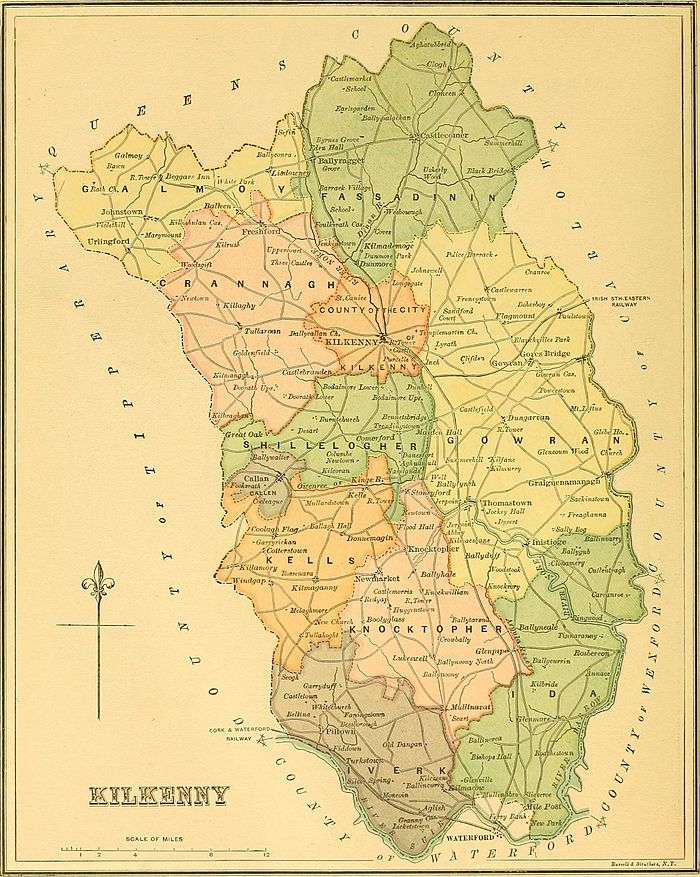
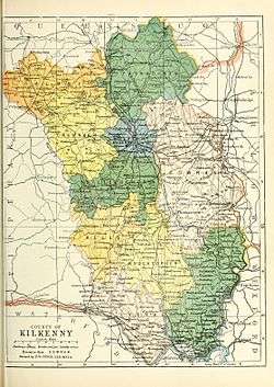
Barony of Fassadinin (Irish: Fásach an Deighnín, meaning "Wilderness along the Dinin river"[3][4]), sometimes written Fassadining, is a barony in the north of County Kilkenny, Ireland.[1][5] The size of the barony is 46,765 acres (189.25 km2).[2]
Geography
Fassadinin contains the towns of Ballyragget and Castlecomer, and the settlements of Odagh, Clogh, Jenkinstown, Coan, Coolcullen and Coolbaun.[6]
Fassadinin contains the civil parishes of Attanagh, Odagh, Castlecomer, Kilmenan, Kilmacar, Kilmademoge, Kilmadum, Coolcraheen, Dysart, Donaghmore, Dunmore, Grangemaccomb, Muckalee, Mayne, Abbeyleix, Mothell, Rathbeagh, Rathaspick and Rosconnell.[7]
The rivers Dinin (Dinan) flows through Fassadinin.[8] Fassadinin contains Castlecomer Woods and Jenkinstown Wood,[9] and a well named 'Lady's Well'.[10]
History
Fassadinin was part of the medieval Irish kingdom of Osraige. It was the territory of the Irish clan Uí Duach. In 1358 this Barony was known by its ancient name the "Cantred of Odoth".[4] The earliest reference to the barony was is 1587 where it was described as the barony of "Fasaghdenyn and Idoghe".[4]
In Edmund Ignatius Hogan's "Description of Ireland, in anno 1598" it was the barony of "Fasagh, Denny, and Idogh"[11] and the constables were of the barony of "Fasagh de Myn and Odoghe" or "Fasaghdenya and Odoghe". Fassadining was recorded in the Down Survey (1656),[12] the 1840 Ordnance Survey Map[13] and on Griffith's Valuation (1864).[14]
In 1247 Geoffrey de Fraxino (de la Freyne) held a quarter Knight's fee at Kilmenan in the barony of Fassadinin held previously by a Walter Purcell.[15] The 1608 constables were Robnett Purcell of Foulksrath and William O'Brena of Ballyhomyn (Ballyhimmin).[4] The early families recorded included O'Brena of Rathcally, Purcell of Esker, Purcell of Lysmayne, O'Brena of Uskertye, Farr McDonnogh of Croghtoncle, and Duffe of Crint.[11] The Wandesfords were based in Fassadining.[16] Foulksrath Castle is located in Fassadinin.[17]
Parts were in the Poor law unions of Castlecomer, Kilkenny, and Urlingford.[2]
See also
Notes
- 1 2 3 4 5 (Government 2003)
- 1 2 3 (Parliament 1862, p. 962, Fassadining Barony)
- ↑ (Fiontar 2008, Fásach an Deighnín/Fassadinin)
- 1 2 3 4 (Carrigan 1905, p. 23, Existing Civil Divisions or Baronies)
- ↑ (Tighe 1802, p. 4, Baronies)
- ↑ (Fiontar 2008, Fassadinin Towns and Fiontar 2008, Fassadinin population centres)
- ↑ (Fiontar 2008, Fassadinin Civil Parishes)
- ↑ (Fiontar 2008, An Deighean/Dinin River)
- ↑ (Fiontar 2008, Castlecomer Woods and Fiontar 2008, Jenkinstown Wood
- ↑ (Fiontar 2008, Lady's Well)
- 1 2 (Hogan 1878, p. 255)
- ↑ Down Survey Project. "Fassadining Map". downsurvey.tcd.ie. The Down Survey Project.
- ↑ (OSI 2016, Maps – 1, 2, 4, 5, 6, 9, 10, 11, 14, 15)
- ↑ (Griffith 1864, Fassadinin Search)
- ↑ (Lewis 1837, Maps)
- ↑ Walsh, Dennis. "The Baronies of Ireland". ancestry.com. and Walsh, Dennis. "Barony Map of the Leinster Region". ancestry.com.
- ↑ (Fiontar 2008, Foulksrath Castle)
Sources
- Carrigan, William (1905). The History and Antiquities of the Diocese of Ossory. Sealy, Bryers & Walker. ISBN 9785879206463.
- Fiontar (2008). "Placenames Database of Ireland". logainm.ie. Department of Community, Rural and Gaeltacht Affairs of the Government of Ireland.
- Government (2003). Placenames (Co. Kilkenny) Order 2003 (PDF). Dublin: Government of Ireland.
- Griffith, Richard John (1864). "Griffith's Valuation". www.askaboutireland.ie.
- Hogan, Edmund Ignatius (1878). The Description of Ireland, and the State thereof as it is at this Present, in anno 1598 (PDF) (1896 ed.). Dublin: M.H. Gill & Son.
- Lewis, Samuel (1837). A Topographical Dictionary of Ireland. Lewis.
- OSI, Ordnance Survey Ireland (2016). "Ordnance Survey". osi.ie.
- Parliament (1862). General alphabetical index to townlands and towns, parishes and baronies of Ireland.
- Tighe, William (1802). Statistical observations relative to the county of Kilkenny: made in the years 1800 & 1801. Printed by Graisberry and Campbell.
External links
- Fiontar (2008). "Placenames Database of Ireland". logainm.ie. Department of Community, Rural and Gaeltacht Affairs of the Government of Ireland.
- Walsh, Dennis. "The Baronies of Ireland". ancestry.com.
- Walsh, Dennis. "Barony Map of the Leinster Region". ancestry.com.
Places adjacent to Barony of Fassadinin | ||||||||||
|---|---|---|---|---|---|---|---|---|---|---|
| ||||||||||
|  | |
| ||