Farmers, Kentucky
| Farmers, Kentucky | |
|---|---|
| Unincorporated community | |
 Farmers, Kentucky  Farmers, Kentucky | |
| Coordinates: 38°08′34″N 83°32′46″W / 38.14278°N 83.54611°WCoordinates: 38°08′34″N 83°32′46″W / 38.14278°N 83.54611°W | |
| Country | United States |
| State | Kentucky |
| County | Rowan |
| Area[1] | |
| • Total | 0.857 sq mi (2.22 km2) |
| • Land | 0.854 sq mi (2.21 km2) |
| • Water | 0.003 sq mi (0.008 km2) |
| Elevation | 673 ft (205 m) |
| Population (2010)[1] | |
| • Total | 284 |
| • Density | 330/sq mi (130/km2) |
| Time zone | UTC-5 (Eastern (EST)) |
| • Summer (DST) | UTC-4 (EDT) |
| ZIP code | 40319 |
| Area code(s) | 606 |
| GNIS feature ID | 512136[2] |
Farmers is an unincorporated community and census-designated place in Rowan County, Kentucky, United States. Its population was 284 as of the 2010 census.[1] Farmers has a post office with ZIP code 40319.[3][4] U.S. Route 60 passes through the community.
Geography
According to the U.S. Census Bureau, the community has an area of 0.857 square miles (2.22 km2); 0.854 square miles (2.21 km2) of its area is land, and 0.003 square miles (0.0078 km2) is water.[1]
References
- 1 2 3 4 "2010 Census Gazetteer Files - Places: Kentucky". U.S. Census Bureau. Retrieved April 2, 2017.
- ↑ "Farmers". Geographic Names Information System. United States Geological Survey.
- ↑ United States Postal Service. "USPS - Look Up a ZIP Code". Retrieved April 2, 2017.
- ↑ "Postmaster Finder - Post Offices by ZIP Code". United States Postal Service. Retrieved April 2, 2017.
Municipalities and communities of Rowan County, Kentucky, United States | ||
|---|---|---|
| Cities | 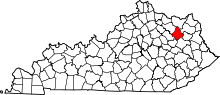 | |
| CDP | ||
| Other unincorporated communities | ||
This article is issued from
Wikipedia.
The text is licensed under Creative Commons - Attribution - Sharealike.
Additional terms may apply for the media files.