Farim
| Farim | ||
|---|---|---|
| ||
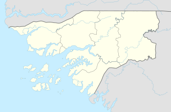 Farim Location in Guinea-Bissau | ||
| Coordinates: 12°29′2″N 15°13′18″W / 12.48389°N 15.22167°W | ||
| Country |
| |
| Region | Oio Region | |
| Founded | 1641 | |
| Elevation | 2 m (7 ft) | |
| Population (2008) | ||
| • Total | 6,405 | |
Farim is a town of northern Guinea-Bissau. It sits on the north bank of the Farim/Cacheu River, about 215 km (135 miles) up the river from Cacheu. Population 6,405 (2008 est).[1]
History
Farim was founded about 1641 by the Captain-Major of Cacheu, who recruited lançados from Geba to move to where they would be less vulnerable to attack by African tribes. The name derived from farim, the title of the local Mandinka people's ruler. For their part, the Mandinkas and Soninke called the settlement Tubabodaga ("village of the whites"). It was well-situated as a port, since the river was continuously navigable by sailing vessels from Cacheu.
It became a presídio (garrisoned place) though an order dated 10 November 1696, in reaction to an anticipated attack from nearby Canico. The area remained generally peaceful, and the defenses gradually deteriorated. It was a base for operations against Oio in 1897 and 1902. Farim started to grow in earnest in the 1910s, with over twenty trading firms based there, and became a vila (town) in 1918.
Farim had become a centro comercial by 1925, and experienced an influx of Lebanese and Syrian merchants, dealing in peanuts and timber. Its economy was hit hard by the independence struggle in the 1960s and 1970s.
Sports
Several sports clubs notably football and athletics are founded in Farim and area, the notable club is SC Farim, the least notable is DRC Farim. These clubs play at the stadium (Farim Stadio) with a capacity of 5,000.
Named after
A Tiny crater on Mars is named after the town and is located in the Eridania quadrangle bordering the northern rim of the larger Kepler. The name was officially approved by the IAU on 11 March 2013.[2]
References
- ↑ World Gazetteer, Retrieved on June 16, 2008
- ↑ "Gazetteer of Planetary Nomenclature | Farim on Mars". usgs.gov. International Astronomical Union. Retrieved 2018-01-10.
- Richard Andrew Lobban, Jr. and Peter Karibe Mendy, Historical Dictionary of the Republic of Guinea-Bissau, 3rd ed. (Scarecrow Press, 1997 ISBN 0-8108-3226-7) pp. 160–163
Coordinates: 12°29′N 15°13′W / 12.483°N 15.217°W
Farim (capital) | ||
| Sectors | ||
| Towns and villages |
| |