Fang (town)
| Fang ฝาง | |
|---|---|
| Subdistrict Municipality | |
| Wiang Fang | |
 | |
 Fang Location of the city within Thailand | |
| Coordinates: 19°55′8″N 99°12′49″E / 19.91889°N 99.21361°ECoordinates: 19°55′8″N 99°12′49″E / 19.91889°N 99.21361°E | |
| Country |
|
| Province | Chiang Mai Province |
| Government | |
| • Type | Subdistrict municipality |
| Area | |
| • Subdistrict Municipality | 2.714 km2 (1.048 sq mi) |
| Population (2009) | |
| • Subdistrict Municipality | 7,635 |
| • Density | 2,813/km2 (7,290/sq mi) |
| • Metro | 24,851 |
| • Metro density | 89.29/km2 (231.3/sq mi) |
| Time zone | UTC+7 (ICT) |
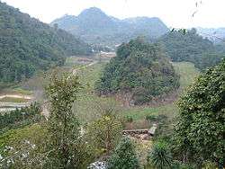
Fang or "Wiang Fang" ("wiang" is a walled city or town) is a town in the northern Chiang Mai Province, Thailand, also known as Thesaban Wiang Fang, the capital of Fang District. It is 154 km north of Chiang Mai, among the highest mountains in the country.
History
According to the Yonok chronicle, Mueang Fang was built in 641 by King Lawa Changkarat. Later King Mengrai the Great reigned in Fang before building Wiang Kum Kam and Chiang Mai of the Lanna Kingdom for one year around 1268. It seems that Mengrai used Mueang Fang for the base to invade Hariphunchai.
Etymology
The landscape of Fang looked like the seed of a fang tree (Caesalpinia sappan). The town was named after the tree.
Geography
Neighboring districts are (from the south clockwise) Mu 1, 10 Tambon San Sai, Mu 7 (Ban Mea Jai) Tambon Wiang, Mu 2, 4 Tambon Wiang, and Mu 2 Tambon Wiang.
Administration
The town is subdivided into 12 boroughs ("chumchon"), which include five villages (muban) of the Wiang subdistrict - Mu 2, 3, 4, 5, and 9.
| No. | Name | Thai name | |
|---|---|---|---|
| 1. | Ton Nun | ชุมชนต้นหนุน | |
| 2. | Pan Naram | ชุมชนปัณณาราม | |
| 3. | Chaeng Hua Rin | ชุมชนแจ่งหัวริน | |
| 4. | Phra Nang Sam Phio | ชุมชนพระนางสามผิว | |
| 5. | Suan Dok | ชุมชนสวนดอก | |
| 6. | Chedi Ngam | ชุมชนเจดีย์งาม | |
| 7. | Pa Bong | ชุมชนป่าบง | |
| 8. | Thep Amnuai | ชุมชนเทพอำนวย | |
| 9. | Ton Hang | ชุมชนต้นฮ่าง | |
| 10. | San Pa Nai | ชุมชนสันป่าไหน่ | |
| 11. | Phai Lom | ชุมชนไผ่ล้อม | |
| 12. | Phai Tong | ชุมชนไผ่ทอง |
Education
The school structure is divided into four key stages: the first three years in elementary school, Prathom 1–3, are for ages 6–8; the second level, Prathom 4–6 are for children 9–11; the third level, Matthayom 1–3, is for ages 12–14. The upper secondary level of schooling consists of Matthayom 4–6 for ages 15–17 and is divided into academic and vocational streams. There are academic upper secondary schools, vocational upper secondary schools, and comprehensive schools offering academic and vocational tracks. Students who choose the academic stream usually intend to enter a university. Vocational schools offer programs that prepare students for employment.
Secondary school (Prathom 1 – Matthayom 3)
- Ban Wiang Fang School (public)
- Saiaksorn School (private)
High school (Prathom 1–Matthayom 6)
Rangsee Vittaya School (Christian school)
Technical college
Thana Technology International College Chiang Mai (private)
Climate
Fang has a tropical wet and dry climate (Köppen climate classification Aw). Winters are fairly dry and warm. Temperatures rise until April, which is average around year at 25 °C (77 °F). The monsoon season runs from late-April through October, with heavy rain and somewhat cooler temperatures during the day, although nights remain warm.
| Climate data for Fang, Thailand | |||||||||||||
|---|---|---|---|---|---|---|---|---|---|---|---|---|---|
| Month | Jan | Feb | Mar | Apr | May | Jun | Jul | Aug | Sep | Oct | Nov | Dec | Year |
| Average high °C (°F) | 29 (84) |
31 (88) |
34 (93) |
35 (95) |
33 (91) |
32 (90) |
31 (88) |
31 (88) |
31 (88) |
31 (88) |
29 (84) |
28 (82) |
31.6 (88.9) |
| Average low °C (°F) | 13 (55) |
14 (57) |
17 (63) |
21 (70) |
22 (72) |
24 (75) |
24 (75) |
23 (73) |
23 (73) |
21 (70) |
17 (63) |
14 (57) |
19.4 (66.9) |
| Source: [1] | |||||||||||||
See also
References
- ↑ "Climatological Information for Fang, Thailand". World Weather Online. Retrieved 2013-05-17.
External links
