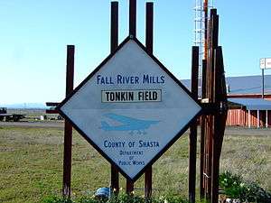
Fall River Mills Airport
| Fall River Mills Airport | |||||||||||
|---|---|---|---|---|---|---|---|---|---|---|---|
| Summary | |||||||||||
| Airport type | Public | ||||||||||
| Location | Fall River Mills, California | ||||||||||
| Elevation AMSL | 3,323 ft / 1,013 m | ||||||||||
| Coordinates | 41°01′07.587″N 121°25′59.93″W / 41.01877417°N 121.4333139°WCoordinates: 41°01′07.587″N 121°25′59.93″W / 41.01877417°N 121.4333139°W | ||||||||||
| Runways | |||||||||||
| |||||||||||
Fall River Mills Airport (FAA LID: O89) is a public airport located off Main Street, in downtown Fall River Mills, serving Shasta County, northern California.[1]
The airport has one runway, and is mostly used for general aviation.[1] It is the only airport within 75 miles (121 km) of Redding and Alturas.
Facilities
Fall River Mills Airport has one runway:
- Runway 2/20: 5,000 x 75 ft (1,524 x 23 m). Surface: Asphalt
The airport has nine permanent t-hangars, five Portable hangars, approximately 30 tie-downs, and provides aviation fuel sales. The airport is equipped with runway lights which are designed to be turned on at night by the pilots as they approach the airport.[1]
History
The airport was originally built in the 1940s as Tonkin Field, a location to train pilots for World War II[2]. Over the years, the airport has been maintained and upgraded largely due to funding provided from the California Aid to Airports Program (CAAP).[3]
References
- 1 2 3 Shasta County D.P.W,http://www.co.shasta.ca.us/index/pw_index/plans_programs/frm_airport.aspx, April, 2010
- ↑ "Fall River Mills". High Country Real Estate. Retrieved 2017-06-13.
- ↑ "Department of Public Works Fall River Mills Airport". archive.li. 2003-12-28. Archived from the original on 2003-12-28. Retrieved 2017-06-13.
- Airport Master Record (FAA Form 5010), also available as a printable form (PDF)
External links
- Resources for this airport:
- FAA airport information for O89
- AirNav airport information for O89
- FlightAware airport information and live flight tracker
- SkyVector aeronautical chart for O89