Fair Plain, Michigan
| Fair Plain, Michigan | |
|---|---|
| Census-designated place & Unincorporated community | |
 Location of Fair Plain within Berrien County, Michigan | |
| Coordinates: 42°5′13″N 86°27′21″W / 42.08694°N 86.45583°WCoordinates: 42°5′13″N 86°27′21″W / 42.08694°N 86.45583°W | |
| Country | United States |
| State | Michigan |
| County | Berrien |
| Townships |
St. Joseph Charter Township Benton Charter Township |
| Area | |
| • Total | 4.4 sq mi (11.5 km2) |
| • Land | 4.2 sq mi (10.9 km2) |
| • Water | 0.2 sq mi (0.6 km2) |
| Elevation | 702 ft (214 m) |
| Population (2010) | |
| • Total | 7,631 |
| • Density | 1,813/sq mi (699.9/km2) |
| Time zone | UTC-5 (Eastern (EST)) |
| • Summer (DST) | UTC-4 (EDT) |
| Area code(s) | 269 |
| FIPS code | 26-27160[1] |
| GNIS feature ID | 625742[2] |
Fair Plain (also "Fairplain"[3][4][5]) is an unincorporated community in Berrien County in the U.S. state of Michigan. It is a census-designated place (CDP) for statistical purposes and has no legal status as a municipality. The population of the CDP was 7,631 at the 2010 census.[6]
History
The community was named for the scenic character of the original town site.[7]
The Fairplain Plaza,[4] located on M-139 just outside Fair Plain, was the first shopping center in the area. The original Fairplain Plaza was largely torn down by the late 1990s, but was subsequently rebuilt and expanded in a different format.[8]
Geography
According to the United States Census Bureau, the CDP has a total area of 4.4 square miles (11.5 km2), of which 4.2 square miles (10.9 km2) is land and 0.23 square miles (0.6 km2), or 5.22%, is water.[6]
The Fair Plain CDP consists of the portion of St. Joseph Charter Township lying northeast of the St. Joseph River and a portion of Benton Charter Township. The CDP's boundaries are the city of Benton Harbor to the north, the St. Joseph River to the west and south, and M-139 to the east.
Demographics
As of the census[1] of 2000, there were 7,828 people, 3,287 households, and 2,116 families residing in the CDP. The population density was 1,860.2 per square mile (717.9/km²). There were 3,436 housing units at an average density of 816.5 per square mile (315.1/km²). The racial makeup of the CDP was 49.08% White, 47.42% Black or African American, 0.46% Native American, 0.66% Asian, 0.06% Pacific Islander, 0.88% from other races, and 1.43% from two or more races. Hispanic or Latino of any race were 1.67% of the population.
There were 3,287 households out of which 27.1% had children under the age of 18 living with them, 43.2% were married couples living together, 17.3% had a female householder with no husband present, and 35.6% were non-families. 29.7% of all households were made up of individuals and 10.0% had someone living alone who was 65 years of age or older. The average household size was 2.37 and the average family size was 2.91.
In the CDP, the population was spread out with 24.5% under the age of 18, 7.7% from 18 to 24, 29.5% from 25 to 44, 24.3% from 45 to 64, and 14.0% who were 65 years of age or older. The median age was 38 years. For every 100 females, there were 91.9 males. For every 100 females age 18 and over, there were 86.7 males.
The median income for a household in the CDP was $37,154, and the median income for a family was $45,950. Males had a median income of $34,524 versus $24,043 for females. The per capita income for the CDP was $20,344. About 10.8% of families and 16.0% of the population were below the poverty line, including 30.5% of those under age 18 and 5.6% of those age 65 or over.
References
- 1 2 "American FactFinder". United States Census Bureau. Archived from the original on 2013-09-11. Retrieved 2008-01-31.
- ↑ U.S. Geological Survey Geographic Names Information System: Fair Plain, Michigan
- ↑ Geographic Names Information System Results for "Fairplain, Berrien County, Michigan"
- 1 2 "Property Profile - Fairplain Plaza". JPA Real Estate. Retrieved 2008-04-01. (Note: JPA sold the plaza in 2006: Eliasohn, Michael (2009-09-19). "Why do they leave?". The Herald-Palladium. Retrieved 2009-09-22. )
- ↑ "BCRC Road Jurisdiction List". Berrien County Road Commission. Archived from the original on 2008-05-13. Retrieved 2008-04-01.
- 1 2 "Geographic Identifiers: 2010 Demographic Profile Data (G001): Fair Plain CDP, Michigan". U.S. Census Bureau, American Factfinder. Retrieved January 13, 2014.
- ↑ "Origins - Old Place Names". Berrien County Genealogical Society. Retrieved 13 March 2018.
- ↑ Dodson, Paul (1999-02-25). "Fairplain gets new lease on life". South Bend Tribune. Retrieved 2009-08-25.
Municipalities and communities of Berrien County, Michigan, United States | ||
|---|---|---|
| Cities | 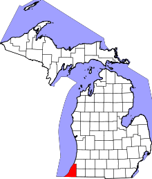 | |
| Villages | ||
| Charter townships | ||
| General law townships | ||
| CDPs | ||
| Other unincorporated communities | ||
| Footnotes | ‡This populated place also has portions in an adjacent county or counties | |