Failand
| Failand | |
|---|---|
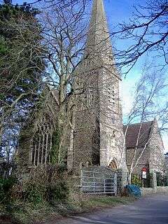 St Bartholomew's, Lower Failand | |
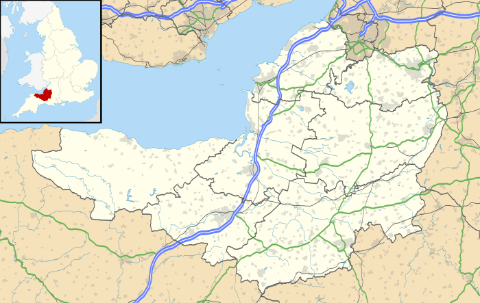 Failand Failand shown within Somerset | |
| OS grid reference | ST525715 |
| Civil parish | |
| Unitary authority | |
| Ceremonial county | |
| Region | |
| Country | England |
| Sovereign state | United Kingdom |
| Post town | BRISTOL |
| Postcode district | BS8 |
| Dialling code | 01275 |
| Police | Avon and Somerset |
| Fire | Avon |
| Ambulance | South Western |
| EU Parliament | South West England |
| UK Parliament | |
Failand is a village in Somerset, England. It lies within the civil parish of Wraxall and Failand and the unitary authority area of North Somerset.
The village has two separate parts. Failand itself is on the B3128 Bristol to Clevedon road, and is the newer and larger part. Lower Failand, a mile away, is the original village (shown as Fayland on old maps). Lower Failand can be reached by single track lanes only.
Failand is home to a post office with general store, a pub (The Failand Inn), an observatory, a church and a well used village hall.
Landmarks

Tyntesfield is a gothic house and estate recently acquired by the National Trust after a national fund-raising campaign. It is still being restored, but is open to visitors.[1] It has been designated as a Grade II* listed building.[2] The entrance is just West of Failand on the B3128.
The Anglican parish church of St Bartholomew in Lower Failand was built in 1883-1887 by E. W. Barnes of Bristol.[3]
Art
Richard Long, the Turner Prize winning Land Artist is a longtime resident of Lower Failand. Roger Fry, a prominent member of the Bloomsbury Group, grew up in Lower Failand.
Social
Failand has a very active village social life. The Failand Society (link below) meets regularly for talks and social events. There is a very active drama group who perform regularly at the village hall. The failanders club puts on events for older residents. And there are two active supper clubs where residents meet up.
Transport
Despite being a rural village, Failand is very close to Bristol, and Clifton in particular. Clifton village is only 5 minutes drive from Failand, via Clifton Suspension Bridge. The X6 bus runs to Bristol city centre about once per hour, via Clarken Combe, Bower Ashton and Hotwells. Lower Failand is on the National Cycle Network. Route 334 provides links to Clifton in one direction, and Portbury and Portishead in the other, linking to routes North and South.
Sport
Failand is home to the playing fields of several Bristol schools, most notably Bristol Grammar School, Bristol Cathedral School, Clifton College, and Queen Elizabeth's Hospital (QEH), whose facilities were formerly used by Bristol Rovers F.C. as their training ground. It is also home to the playing fields of the Old Bristolians Society.
Failand has its own cricket club, Failand & Portbury C.C., who play on Horse Race Lane in Lower Failand.
There are two golf clubs in Failand, namely Bristol & Clifton Golf Club and Long Ashton Golf Club.
 Manor farm, Failand
References
- ↑ Siddique, Haroon (2008-08-05). "Bombs, bears and a carved coconut: inside a neo-Gothic treasure trove". The Guardian. p. 8. Retrieved 2008-08-05.
- ↑ "Tyntesfield". Images of England. English Heritage. Retrieved 2009-02-05.
- ↑ "St Bartholomew's Church". Images of England. English Heritage. Retrieved 2009-02-05.
External links
| Wikimedia Commons has media related to Failand. |