Ewhurst, East Sussex
| Ewhurst | |
|---|---|
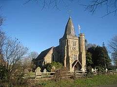 St James' Church, Ewhurst Green | |
 Ewhurst Ewhurst shown within East Sussex | |
| Area | 23.64 km2 (9.13 sq mi) [1] |
| Population | 1,130 (2011) [2] |
| • Density | 115.3/sq mi (44.5/km2) |
| OS grid reference | TQ799238 |
| • London | 46 miles (74 km) NW |
| District | |
| Shire county | |
| Region | |
| Country | England |
| Sovereign state | United Kingdom |
| Post town | ROBERTSBRIDGE |
| Postcode district | TN32 5 |
| Dialling code | 01580 |
| Police | Sussex |
| Fire | East Sussex |
| Ambulance | South East Coast |
| EU Parliament | South East England |
| UK Parliament | |
Ewhurst is a civil parish in the Rother district of East Sussex, England; its main settlement is the village of Ewhurst Green, which is located 10 miles (16 km) north of Hastings in the valley of the River Rother. The parish is a relatively large one in area, and includes the settlements of Staplecross and Cripps Corner. The former A229 road (now the B2244) crosses the parish from north to south.
Although Bodiam station is the present terminus of the Kent and East Sussex Railway, and lies within the parish, the castle itself is in the neighbouring parish of Bodiam.
The parish church is dedicated to St. James the Greater.[3] The public house in Ewhurst Green is The White Dog.
Governance
Ewhurst is part of the electoral ward called Ewhurst and Sedlescombe. The population of this ward at the 2011 census was 2,606.[4]
References
- ↑ "East Sussex in Figures". East Sussex County Council. Retrieved 2008-04-26.
- ↑ "Civil Parish population 2011". Retrieved 7 October 2015.
- ↑ St James the Great parish church
- ↑ "Ewhurst and Sedlescombe ward population 2011". Retrieved 7 October 2015.
External links
| Wikimedia Commons has media related to Ewhurst. |