Erwin, North Carolina
| Erwin, North Carolina | |
|---|---|
| Town | |
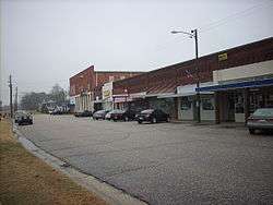 Downtown Erwin | |
| Motto(s): "Front Porch Friends"[1] | |
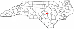 Location of Erwin, North Carolina | |
| Coordinates: 35°19′22″N 78°40′19″W / 35.32278°N 78.67194°WCoordinates: 35°19′22″N 78°40′19″W / 35.32278°N 78.67194°W | |
| Country | United States |
| State | North Carolina |
| County | Harnett |
| Government | |
| • Mayor | Patsy Carson |
| Area | |
| • Total | 4.23 sq mi (10.95 km2) |
| • Land | 4.19 sq mi (10.85 km2) |
| • Water | 0.04 sq mi (0.10 km2) |
| Elevation | 187 ft (57 m) |
| Population (2010) | |
| • Total | 4,405 |
| • Estimate (2016)[2] | 4,931 |
| • Density | 1,177/sq mi (454.3/km2) |
| Time zone | UTC-5 (Eastern (EST)) |
| • Summer (DST) | UTC-4 (EDT) |
| ZIP code | 28339 |
| Area code(s) | 910 |
| FIPS code | 37-21740[3] |
| GNIS feature ID | 1020169[4] |
| Website |
www |
Erwin is a town in Harnett County, North Carolina, United States. The population was 4,405 at the 2010 census,[5] and was estimated in 2016 to be 4,931.[2] Erwin is a part of the Dunn Micropolitan Area, which is also a part of the greater Raleigh–Durham–Cary Combined Statistical Area (CSA) as defined by the United States Census Bureau.
History
Prior to Erwin, there was a colonial-era settlement in the area known as "Averasboro". The Battle of Averasborough was fought nearby during the American Civil War. In 1904, the Duke family built the Erwin Cotton Mill, which closed in 2000. The new town was named "Duke" after the founding shareholders. In 1925, the name was changed to "Erwin" because of the formation of Duke University in Durham, North Carolina.[6] Oak Grove and the Averasboro Battlefield Historic District are listed on the National Register of Historic Places.[7]
Geography
Erwin is located in eastern Harnett County at 35°19′22″N 78°40′19″W / 35.32278°N 78.67194°W (35.322840, −78.672005).[8] It is bordered to the east by the city of Dunn. U.S. Route 421 passes through the northeast side of the town, leading northwest 12 miles (19 km) to Lillington, the county seat, and east through Dunn 5 miles (8 km) to Interstate 95. North Carolina Highway 55 leads north from Erwin 14 miles (23 km) to Angier. State highways 82 and 217 pass through the center of Erwin as 13th Street. Highway 82 leads south 9 miles (14 km) to Godwin, while Highway 217 leads southwest 7 miles (11 km) to Linden. Fayetteville is 25 miles (40 km) to the southwest via Highway 217 and U.S. Route 401.
According to the United States Census Bureau, the town of Erwin has a total area of 4.23 square miles (10.95 km2), of which 0.04 square miles (0.10 km2), or 0.91%, are water.[5] The Cape Fear River forms part of the western border of the town.
Demographics
| Historical population | |||
|---|---|---|---|
| Census | Pop. | %± | |
| 1950 | 3,344 | — | |
| 1960 | 3,183 | −4.8% | |
| 1970 | 2,852 | −10.4% | |
| 1980 | 2,828 | −0.8% | |
| 1990 | 4,061 | 43.6% | |
| 2000 | 4,537 | 11.7% | |
| 2010 | 4,405 | −2.9% | |
| Est. 2016 | 4,931 | [2] | 11.9% |
| U.S. Decennial Census[9] | |||
As of the census[3] of 2000, there were 4,537 people, 1,896 households, and 1,287 families residing in the town. The population density was 1,128.8 people per square mile (435.8/km²). There were 2,032 housing units at an average density of 505.6 per square mile (195.2/km²). The racial makeup of the town was 80.63% White, 15.96% African American, 0.55% Native American, 0.09% Asian, 1.79% from other races, and 0.99% from two or more races. Hispanic or Latino of any race were 4.14% of the population.
There were 1,896 households out of which 29.2% had children under the age of 18 living with them, 50.9% were married couples living together, 12.5% had a female householder with no husband present, and 32.1% were non-families. 28.3% of all households were made up of individuals and 14.9% had someone living alone who was 65 years of age or older. The average household size was 2.38 and the average family size was 2.90.
In the town, the population was spread out with 23.7% under the age of 18, 6.9% from 18 to 24, 27.9% from 25 to 44, 23.5% from 45 to 64, and 17.9% who were 65 years of age or older. The median age was 39 years. For every 100 females, there were 90.9 males. For every 100 females age 18 and over, there were 89.0 males.
The median income for a household in the town was $29,521, and the median income for a family was $41,270. Males had a median income of $29,610 versus $22,650 for females. The per capita income for the town was $18,282. About 16.4% of families and 20.7% of the population were below the poverty line, including 22.2% of those under age 18 and 31.3% of those age 65 or over.
Erwin includes three schools: Gentry Primary, Erwin Elementary, and Triton High School.
Watersphere
In early 2012, Erwin became home to the tallest sphere-topped water tower. The 219.75-foot (66.98 m) structure is about eight feet (2.4 m) taller than the previous record holder, the Union Watersphere in Union, New Jersey.[10]
Notable people
- Al Woodall, NFL quarterback
References
- ↑ "Erwin North Carolina". Town of Erwin. Retrieved December 13, 2017.
- 1 2 3 "Population and Housing Unit Estimates". Retrieved June 9, 2017.
- 1 2 "American FactFinder". United States Census Bureau. Archived from the original on 2013-09-11. Retrieved 2008-01-31.
- ↑ "US Board on Geographic Names". United States Geological Survey. 2007-10-25. Retrieved 2008-01-31.
- 1 2 "Geographic Identifiers: 2010 Census Summary File 1 (G001): Erwin town, North Carolina". American Factfinder. U.S. Census Bureau. Retrieved December 13, 2017.
- ↑ "Discover Erwin". Town of Erwin, North Carolina. Retrieved December 13, 2017.
- ↑ National Park Service (2010-07-09). "National Register Information System". National Register of Historic Places. National Park Service.
- ↑ "US Gazetteer files: 2010, 2000, and 1990". United States Census Bureau. 2011-02-12. Retrieved 2011-04-23.
- ↑ "Census of Population and Housing". Census.gov. Archived from the original on May 12, 2015. Retrieved June 4, 2015.
- ↑ Rose, Lisa (February 22, 2012), "Despite challenge, Union Township water tower remains a Jersey landmark", The Star-Ledger, retrieved 2012-02-21
External links
Municipalities and communities of Harnett County, North Carolina, United States | ||
|---|---|---|
| City |  | |
| Towns | ||
| Townships | ||
| CDPs | ||
| Unincorporated communities | ||
| Footnotes | ‡This populated place also has portions in an adjacent county or counties | |