Errachidia Province
| Province of Errachidia | |
|---|---|
| Province | |
|
Tamnaḍt n Imteɣren إقليم الراشيدية | |
 Province of Errachidia | |
| Coordinates: 31°55′49″N 4°25′23″W / 31.930385°N 4.423088°WCoordinates: 31°55′49″N 4°25′23″W / 31.930385°N 4.423088°W | |
| Country |
|
| Region | Drâa-Tafilalet |
| Capital | Errachidia |
| Government | |
| • Governor | Abdellah Amimi |
| Area | |
| • Total | 60,000 km2 (20,000 sq mi) |
| Population (2004)[1] | |
| • Total | 556,612 |
| • Density | 8.7/km2 (23/sq mi) |
| Website | http://www.errachidia.org/ |
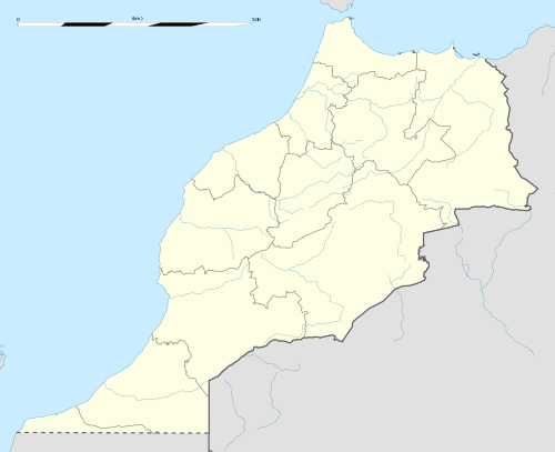
Errachidia or Er-rachidia (Berber languages: Imteɣren) is a province located in southeast Morocco, in the Drâa-Tafilalet region. Errachidia is bordered by the province of Figuig to the east, Beni Mellal and Azilal Khenifra to the west, Boulmane to the north and Algeria to the south. It is considered to be one of the most historically important regions of Morocco.
Errachidia, whose former name is Ksar Souk, was named My Rachid, in tribute to one of the main founders of the Alaouite dynasty, the current Moroccan royal family.
Cities
Subdivisions
The province is divided administratively into the following:[2]
| Name | Geographic code | Type | Households | Population (2004) | Foreign population | Moroccan population | Notes |
|---|---|---|---|---|---|---|---|
| Arfoud | 201.01.01. | Municipality | 4035 | 23637 | 5 | 23632 | |
| Boudnib | 201.01.03. | Municipality | 1828 | 9867 | 1 | 9866 | |
| Errachidia | 201.01.05. | Municipality | 14624 | 76759 | 47 | 76712 | |
| Er-Rich | 201.01.07. | Municipality | 4002 | 20155 | 9 | 20146 | [3] |
| Goulmima | 201.01.09. | Municipality | 3054 | 16593 | 3 | 16590 | |
| Jorf | 201.01.11. | Municipality | 1981 | 12135 | 1 | 12134 | |
| Moulay Ali Cherif | 201.01.13. | Municipality | 3251 | 20469 | 1 | 20468 | |
| Tinejdad | 201.01.15. | Municipality | 1289 | 7494 | 2 | 7492 | |
| Aarab Sebbah Gheris | 201.03.01. | Rural commune | 688 | 4937 | 0 | 4937 | |
| Aarab Sebbah Ziz | 201.03.03. | Rural commune | 2578 | 18332 | 1 | 18331 | |
| Es-Sifa | 201.03.07. | Rural commune | 1022 | 7881 | 0 | 7881 | |
| Fezna | 201.03.09. | Rural commune | 585 | 4087 | 1 | 4086 | |
| Amellagou | 201.05.03. | Rural commune | 890 | 5273 | 0 | 5273 | |
| Aoufous | 201.07.01. | Rural commune | 1929 | 11506 | 0 | 11506 | 1272 residents live in the center, called Aoufous; 10234 residents live in rural areas. |
| Chorfa M'Daghra | 201.07.03. | Rural commune | 2133 | 13803 | 0 | 13803 | |
| Er-Rteb | 201.07.05. | Rural commune | 2081 | 13324 | 1 | 13323 | |
| Lkheng | 201.07.07. | Rural commune | 2190 | 13017 | 1 | 13016 | |
| Oued Naam | 201.07.09. | Rural commune | 1000 | 5709 | 3 | 5706 | |
| En-Nzala | 201.09.01. | Rural commune | 869 | 5186 | 0 | 5186 | [3] |
| Gourrama | 201.09.03. | Rural commune | 2453 | 13426 | 1 | 13425 | 3987 residents live in the center, called Gourrama; 9439 residents live in rural areas.[3] |
| Guers Tiaallaline | 201.09.05. | Rural commune | 2086 | 11931 | 1 | 11930 | [3] |
| Guir | 201.09.07. | Rural commune | 668 | 3499 | 0 | 3499 | [3] |
| M'Zizel | 201.09.09. | Rural commune | 1062 | 6443 | 1 | 6442 | [3] |
| Sidi Aayad | 201.09.11. | Rural commune | 1235 | 7424 | 0 | 7424 | [3] |
| Zaouiat Sidi Hamza | 201.09.13. | Rural commune | 711 | 4595 | 1 | 4594 | [3] |
| Bni M'Hamed Sijelmassa | 201.11.01. | Rural commune | 2282 | 16709 | 0 | 16709 | |
| Er-Rissani | 201.11.03. | Rural commune | 727 | 5575 | 3 | 5572 | |
| Es-Sfalat | 201.11.05. | Rural commune | 2147 | 16163 | 0 | 16163 | |
| Et-Taous | 201.11.07. | Rural commune | 820 | 5337 | 1 | 5336 | |
| Sidi Ali | 201.11.09. | Rural commune | 385 | 3081 | 0 | 3081 | |
| Aghbalou N'Kerdous | 201.13.01. | Rural commune | 1306 | 9357 | 0 | 9357 | |
| Ferkla El Oulia | 201.13.03. | Rural commune | 3010 | 20214 | 2 | 20212 | |
| Ferkla Es-Soufla | 201.13.05. | Rural commune | 1713 | 12624 | 0 | 12624 | |
| Gheris El Ouloui | 201.13.07. | Rural commune | 1685 | 11879 | 0 | 11879 | |
| Gheris Es-Soufli | 201.13.09. | Rural commune | 1024 | 6742 | 0 | 6742 | |
| Melaab | 201.13.11. | Rural commune | 2340 | 16681 | 1 | 16680 | |
| Tadighoust | 201.13.13. | Rural commune | 1218 | 7346 | 1 | 7345 | |
| Ait Yahya | 201.15.01. | Rural commune | 713 | 4455 | 0 | 4455 | [3] |
| Amouguer | 201.15.03. | Rural commune | 779 | 5119 | 0 | 5119 | [3] |
| Bou Azmou | 201.15.05. | Rural commune | 1468 | 8903 | 0 | 8903 | [3] |
| Imilchil | 201.15.07. | Rural commune | 1364 | 8222 | 0 | 8222 | [3] |
| Outerbat | 201.15.09. | Rural commune | 1041 | 6137 | 0 | 6137 | [3] |
References
- ↑ http://futur.oasis.ifrance.com/Information_Tourisme_Errachidia.pdf
- ↑ "Recensement général de la population et de l'habitat de 2004" (PDF). Haut-commissariat au Plan, Lavieeco.com. Archived from the original (PDF) on 23 April 2012. Retrieved 27 April 2012.
- 1 2 3 4 5 6 7 8 9 10 11 12 13 Part of Midelt Province since 2009.
External links
This article is issued from
Wikipedia.
The text is licensed under Creative Commons - Attribution - Sharealike.
Additional terms may apply for the media files.