Erindale, Saskatoon
| Erindale | |
|---|---|
| Neighbourhood | |
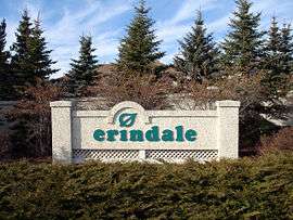 Erindale entrance sign | |
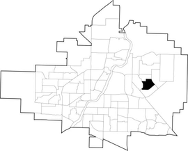 Erindale location map | |
| Coordinates: 52°8′25″N 106°34′17″W / 52.14028°N 106.57139°WCoordinates: 52°8′25″N 106°34′17″W / 52.14028°N 106.57139°W | |
| Country |
|
| Province |
|
| City | Saskatoon |
| Suburban Development Area | University Heights |
| Neighbourhood | Erindale |
| Annexed | 1980-1984 |
| Construction | 1986-2001 |
| Government | |
| • Type | Municipal (Ward 10) |
| • Administrative body | Saskatoon City Council |
| • Councillor | Zach Jeffries |
| Area | |
| • Total | 1.35 km2 (0.52 sq mi) |
| Population (2011) | |
| • Total | 4,338 |
| • Average Income | $123,336 |
| Time zone | UTC-6 (UTC) |
| Website |
www |
Erindale is a primarily residential neighbourhood located in northeast Saskatoon, Saskatchewan, Canada. It is mostly made up of low-density single detached dwellings. As of 2011, the area is home to 4,338 residents. The neighbourhood is considered a high-income area, with an average family income of $123,336, an average dwelling value of $340,990 and a home ownership rate of 95.3%.[1][2] According to MLS data, the average sale price of a home as of 2013 was $398,768.[3]
History
The land on which Erindale now sits was annexed over three decades: 1950 to 1959, 1970 to 1979, and 1980 to 1984.[2] The majority of residential construction was done between 1986 and 2001, with a small amount of construction before this. The housing stock is composed mostly of low density, single detached houses.[1] Roadways feature the names of local artists of some fame.[2] Father Robinson School was built starting in 1989, and opened in the fall of 1992.[4]
Government and politics
Erindale exists within the federal electoral district of Saskatoon—University. It is currently represented by Brad Trost of the Conservative Party of Canada, first elected in 2004 and re-elected in 2006, 2008, 2011 and 2015.[5]
Provincially, the area is within the constituency of Saskatoon Willowgrove. It is currently represented by Ken Cheveldayoff of the Saskatchewan Party, first elected in 2003.[6]
In Saskatoon's non-partisan municipal politics, Erindale lies within ward 10. It is currently represented by Zach Jeffries, first elected in 2012.[7]
Institutions
Education
- Dr. John G. Egnatoff School - public elementary, part of the Saskatoon Public School Division.[10] Named in honour of Dr. John Egnatoff, a former teacher, principal and university professor.[11]
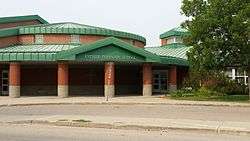
- Father Robinson School - separate (Catholic) elementary, part of Greater Saskatoon Catholic Schools.[12]
Parks and recreation
- Don Ross Park (0.5 acres)
- John Avant Park (21.2 acres)
- Ernest Lindner Park (13.2 acres) - features a fully accessible playground for disabled children[13]
The Erindale/Arbor Creek Community Association organizes events and activities for its residents. Programs operate out of Father Robinson, and Dr. John G. Egnatoff Schools as well as neighbourhood parks. The Association also plays an important role in representing the interests of residents in key community issues such as schools and parks.[14]
Commercial
Because of the adjacent University Heights Suburban Centre, there is almost no commercial development in Erindale. There is only one commercial building - a Mac's convenience store on the corner of Kenderdine Road and Kerr Road. 52 home-based businesses exist in the area.[1]
Location
Erindale is located within the University Heights Suburban Development Area. It is bounded by McOrmond Drive to the east, Kerr Road to the south, Berini Drive to the west, and 115th Street/Kenderdine Road/Attridge Drive/ to the north. Inside those boundaries, the roads are a mix of local and collector roads.
References
- 1 2 3 "Erindale" (PDF). Neighbourhood Profiles. City of Saskatoon. 2012. Retrieved 2012-10-15.
- 1 2 3 "Populace Spring 2006" (PDF). City of Saskatoon. 2006. Archived from the original (PDF) on 2007-12-01. Retrieved 2007-10-31.
- ↑ "Erindale". Saskatoon Realty. Retrieved 2014-01-08.
- ↑ "School History". Greater Saskatoon Catholic Schools. Retrieved 2015-07-01.
- ↑ Current Members of Parliament, retrieved 2017-04-16
- ↑ Legislative Assembly of Saskatchewan - Members of the Legislative Assembly, retrieved 2017-04-16
- ↑ City Councillors - Saskatoon.ca, retrieved 2017-04-16
- ↑ Celebrating a Century of Faith and Learning - A History of Saskatoon's Catholic Schools. Greater Saskatoon Catholic Schools. 2015. p. 168. ISBN 978-0-9947443-0-2.
- 1 2 Active List of Saskatchewan Schools/Programs (PDF), retrieved 2018-02-10
- ↑ "Dr. John G. Egnatoff School". Saskatoon Public School Division. Retrieved 2007-11-10.
- ↑ "John G. Egnatoff". Archived from the original on 2007-08-09. Retrieved 2007-11-10.
- ↑ "Father Robinson School". Greater Saskatoon Catholic Schools. Retrieved 2015-07-03.
- ↑ "Everybody's Playground". Erindale/Arbor Creek Community Association. Archived from the original on 2008-12-10. Retrieved 2007-11-10.
- ↑ "Erindale/Arbor Creek Community Association". City of Saskatoon - Leisure Services & Community Development. Archived from the original on 2007-10-20. Retrieved 2007-11-10.
External links
| Wikimedia Commons has media related to Erindale. |
Places adjacent to Erindale, Saskatoon | |
|---|---|