Ende Regency
| Ende Regency Kabupaten Ende | ||
|---|---|---|
| Regency | ||
| ||
 Location within East Nusa Tenggara | ||
 Ende Regency  Ende Regency Ende Regency (Lesser Sunda Islands)  Ende Regency Ende Regency (Indonesia) | ||
| Coordinates: 8°50′26″S 121°39′50″E / 8.84056°S 121.66389°ECoordinates: 8°50′26″S 121°39′50″E / 8.84056°S 121.66389°E | ||
| Country |
| |
| Province |
| |
| Capital | Ende | |
| Government | ||
| • Regent | Marselinus Y. W. Petu | |
| • Vice Regent | Djafar Achmad | |
| Area | ||
| • Total | 790.20 sq mi (2,046.62 km2) | |
| Population (2010 Census) | ||
| • Total | 260,428 | |
| • Density | 330/sq mi (130/km2) | |
| Time zone | UTC+8 (ICST) | |
| Area code | (+62) 381 | |
| Website |
endekab | |

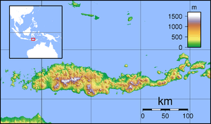
Ende Regency is one of the regencies which divide the island of Flores, within East Nusa Tenggara Province, Indonesia. The town of Ende is the capital of Ende Regency. The area of Ende Regency is 2,046.62 km2, and at the 2010 Census it had a population of 260,428.
The Kelimutu National Park which contains the well-known tourist attraction of Mount Kelimutu with three coloured lakes is in Ende Regency.
Administration
The Ende Regency is divided into twenty districts (kecamatan), tabulated below with their 2010 Census population.
| Name | Population Census 2010 |
|---|---|
| Nangapanda | 19,842 |
| Pulau Ende (Ende Island) | 7,754 |
| Maukaro | 6,967 |
| Ende | 15,062 |
| Ende Selatan (South Ende) | 23,869 |
| Ende Timur (East Ende) | 19,808 |
| Ende Tengah (Central Ende) | 27,942 |
| Ende Utara (North Ende) | 18,100 |
| Ndona | 12,392 |
| Ndona Timur (East Ndona) | 5,062 |
| Wolowaru | 16,051 |
| Wolojita | 6,200 |
| Lio Timur (East Lio) | 7,233 |
| Kelimutu | 7,604 |
| Ndori | 5,128 |
| Maurole | 11,396 |
| Kotabaru | 12,606 |
| Detukeli | 6,787 |
| Detusoko | 13,320 |
| Wewaria | 16,492 |
External links
Regencies and cities of East Nusa Tenggara | ||
|---|---|---|
Capital: Kupang | ||
| Regencies |  | |
| Cities | ||
This article is issued from
Wikipedia.
The text is licensed under Creative Commons - Attribution - Sharealike.
Additional terms may apply for the media files.