Ell, Luxembourg
| Ell Ell | ||
|---|---|---|
| Commune | ||
 | ||
| ||
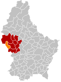 Map of Luxembourg with Ell highlighted in orange, and the canton in dark red | ||
| Coordinates: 49°46′00″N 5°51′00″E / 49.7667°N 5.85°ECoordinates: 49°46′00″N 5°51′00″E / 49.7667°N 5.85°E | ||
| Country |
| |
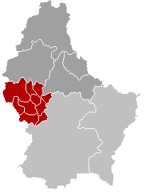
| Canton | Redange | |
| Government | ||
| • Mayor | Joseph Thill | |
| Area | ||
| • Total | 21.55 km2 (8.32 sq mi) | |
| Area rank | 47 of 102 | |
| Highest elevation | 508 m (1,667 ft) | |
| • Rank | 18th of 102 | |
| Lowest elevation | 268 m (879 ft) | |
| • Rank | 75th of 102 | |
| Population (2014) | ||
| • Total | 1,191 | |
| • Rank | 91st of 102 | |
| • Density | 55/km2 (140/sq mi) | |
| • Density rank | 87th of 102 | |
| Time zone | UTC+1 (CET) | |
| • Summer (DST) | UTC+2 (CEST) | |
| LAU 2 | LU00003003 | |
| Website | ell.lu | |

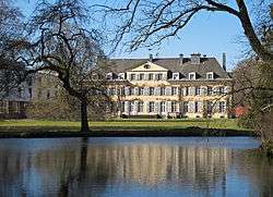
Ell is a commune and small town in western Luxembourg, in the canton of Redange. It lies close to the border with Belgium.
As of 2005, the town of Ell, which lies in the south-east of the commune, has a population of 340. Other towns within the commune include Colpach-Bas, Colpach-Haut, and Roodt.
External links

 | ||
This article is issued from
Wikipedia.
The text is licensed under Creative Commons - Attribution - Sharealike.
Additional terms may apply for the media files.