Eliot station
ELIOT | |||||||||||||
|---|---|---|---|---|---|---|---|---|---|---|---|---|---|
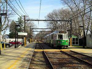 Inbound train at Eliot in March 2016 | |||||||||||||
| Location |
Lincoln Street near Boylston Street Newton, Massachusetts | ||||||||||||
| Coordinates | 42°19′08″N 71°12′59″W / 42.31889°N 71.21639°WCoordinates: 42°19′08″N 71°12′59″W / 42.31889°N 71.21639°W | ||||||||||||
| Owned by | Massachusetts Bay Transportation Authority | ||||||||||||
| Line(s) | |||||||||||||
| Platforms | 2 side platforms | ||||||||||||
| Tracks | 2 | ||||||||||||
| Connections |
| ||||||||||||
| Construction | |||||||||||||
| Parking | 55 spaces ($6.00 daily) | ||||||||||||
| Bicycle facilities | 8 spaces | ||||||||||||
| History | |||||||||||||
| Opened | July 4, 1959[1] | ||||||||||||
| Traffic | |||||||||||||
| Passengers (2011) | 814 (weekday average boardings)[2] | ||||||||||||
| Services | |||||||||||||
| |||||||||||||
| |||||||||||||
Eliot is a light rail station on the MBTA Green Line "D" Branch located just north of Route 9 (Boylston Street) between the Newton Highlands and Newton Upper Falls villages of Newton, Massachusetts. The station has a parking lot at the end of Lincoln Street, a pedestrian entrance from Meredith Street, and pedestrian entrances from both sides of Route 9. A footbridge, built in 1977, crosses Route 9 adjacent to the railroad bridge.
Station layout
| G Street/ Platform level |
Side platform, doors will open on the right | |
| Outbound | ← "D" Branch toward Riverside (Waban) | |
| Inbound | → "D" Branch toward Government Center (Newton Highlands) → | |
| Side platform, doors will open on the right | ||
Bus connections
One MBTA Bus route, the 59 Needham Junction - Watertown Square via Newtonville, stops two blocks to the east at Woodward Street.[3] Although the connection is announced on both modes, Newton Highlands one stop to the east offers a closer connection between the two services.
References
- ↑ Belcher, Jonathan (19 March 2016). "Changes to Transit Service in the MBTA district 1964-2016" (PDF). NETransit. Retrieved 22 March 2016.
- ↑ "Ridership and Service Statistics" (PDF) (14th ed.). Massachusetts Bay Transportation Authority. 2014.
- ↑ "Eliot Station Neighborhood Map" (PDF). Massachusetts Bay Transportation Authority. April 2012. Retrieved 22 March 2016.
External links
![]()
- MBTA - Eliot
- Google Maps Street View: Lincoln Street entrance, Boylston Street entrance