Eleutheropolis
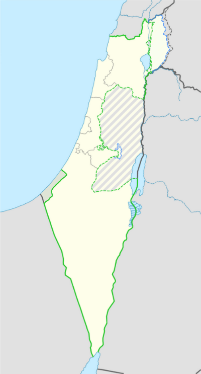
 Location within Israel | |
| Location | Beit Guvrin, Israel |
|---|---|
| Coordinates | 31°36′47.15″N 34°53′53.87″E / 31.6130972°N 34.8982972°E |
| Type | City |
| History | |
| Founded | 3rd century CE |
- For the history of the site see in chronological order Maresha, Beit Guvrin, Eleutheropolis, Bethgibelin, Bayt Jibrin, Kibbutz Beit Guvrin and Beit Guvrin National Park
Eleutheropolis (Greek, Ελευθερόπολις, "Free City") was a Roman and Byzantine city in Syria Palaestina, some 53 km southwest of Jerusalem. Its remains still straddle the ancient road connecting Jerusalem to Gaza and are now located within the Beit Guvrin National Park.
Name
The city was originally known in Aramaic as Beth Gabra, which translates as the "house of strong men".[1] Ptolemy referred to it as Baitogabra,[2] Josephus called it Betaris,[3][4] and in the Talmud it was known as Beit Guvrin.[1][5] The name Eleutheropolis was given to the city by the Romans[6][7] at the beginning of the third century. The former city of Eleutheropolis was rebuilt by the Crusaders as Bethgibelin or Gibelin.[8][9] The medieval city was known in Arabic as Beit Jibrin or Jubrin (بيت جبرين), meaning "house of the powerful"[10] and reflecting its original Aramaic name.[1]
History
Background: Jewish/Idumean Betaris
In 68 CE, during the Jewish War, Vespasian slaughtered or enslaved the inhabitants of Betaris. According to Josephus: "When he had seized upon two villages, which were in the very midst of Idumea, Betaris, and Caphartobas, he slew above ten thousand of the people, and carried into captivity above a thousand, and drove away the rest of the multitude, and placed no small part of his own forces in them, who overran and laid waste the whole mountainous country."[11]
The settlement was demolished once again during the Bar Kokhba revolt, 132–135 CE.
Roman and Byzantine Eleutheropolis
In the year 200, Roman Emperor Septimius Severus gave it the status of a city under a new Greek name, Eleutheropolis, meaning "City of the Free", and its inhabitants were given the ius italicum.[12][13] }}</ref>[6][7] Coins minted by Septimius Severus bear the date January 1, 200, commemorating its founding[14] and the title of polis.
Eleutheropolis became one of the most important cities in Roman Palestine. Seven routes met at Eleutheropolis,[15] and Eusebius, in his Onomasticon, uses the Roman milestones indicating the city as a central point from which the distances of other towns were measured.[7] Eleutheropolis was a "City of Excellence" in the fourth century[16] and a Christian bishopric with the largest territory in Palaestina: its first known bishop is Macrinus, who attended the Council of Nicaea in 325.
Epiphanius of Salamis, the bishop of Salamis in Cyprus, was born at Eleutheropolis; at Ad nearby he established a monastery which is often mentioned in the polemics of Jerome with Rufinus and John, Bishop of Jerusalem.
The Madaba Map (dated 542-570 CE) shows Eleutheropolis as a walled city with three towers, a curving street with a colonnade in the central part and an important basilica. In the centre is a building with a yellowish-white dome on four columns.[17] Eleutheropolis was last mentioned in the ancient sources by the near contemporary itinerarium of the Piacenza Pilgrim,[18] about 570.
At Eleutheropolis, according to the hagiographies, fifty soldiers of the garrison of Gaza, who had refused to deny Christ were beheaded in 638: later a church was built in their honor.[19] In 796, the city was again destroyed in civil warfare.
19th century identification
In 1838, American scholar Edward Robinson identified Bayt Jibrin as the site of ancient Eleutheropolis.[20] Eleutheropolis remains a titular see in the Roman Catholic Church.[21]
See also
- Bayt Jibrin for most elaborate presentation (history, archaeology etc.)
- Beit Guvrin-Maresha National Park
- Kibbutz Beit Guvrin
- Maresha
References
- 1 2 3 Sharon, 1997, p.109
- ↑ The Protestant Theological and Ecclesiastical Encyclopedia (1860) By John Henry Augustus Bomberger, Johann Jakob Herzog p 178
- ↑ The Jewish Wars Josephus Flavius IV:447. Note: Page 270 in the 1981 Penguin Classics edition.
- ↑ Robinson, Edward & Smith, Eli (1856) J. Murray. p. 67
- ↑ Jewish Encyclopedia, s.v. "Eleutheropolis".
- 1 2 Biblical Researches in Palestine and the Adjacent Regions: A Journal of ... Edward Robinson, Eli Smith
- 1 2 3

- ↑ Jean Richard (1921) "The Crusaders c1071-c1291" reprinted 2001 Cambridge University Press ISBN 0-521-62566-1 p. 140
- ↑ The Guide to Israel, Zev Vilnay, Hamakor Press, Jerusalem 1972, p.276
- ↑ Khalidi, 1992, p. 209-210.
- ↑ Josephus, De Bell. Jud., IV.viii.1
- ↑ Negev, Avraham; Gibson, Shimon (2001). Archaeological Encyclopedia of the Holy Land. Continuum. p. 78. ISBN 978-0-8264-1316-1.
- ↑ Murphy-O'Connor, Jerome (28 February 2008). The Holy Land: An Oxford Archaeological Guide from Earliest Times to 1700. OUP Oxford. pp. 217–. ISBN 978-0-19-152867-5.
- ↑ Catholic Encyclopedia, s.v. "Eleutheropolis"
- ↑ Amos Kloner, 1999. "The City of Eleutheropolis": in The Madaba Map Centenary 1897-1997, (Jerusalem) pp 244-246.]
- ↑ Kloner 1999
- ↑ "Madaba Map Online". Christusrex.
- ↑ Anonymus Placentinus Itinerarium 32
- ↑ Catholic Encyclopedia 1908, s.v. "Eleutheropolis"
- ↑ Biblical researches in Palestine, 1838-52. A journal of travels in the year 1838. P. 57ff: Eleutheropolis 1856,
- ↑ Eleutheropolis in Palaestina (Titular See)
External links
- Edward Robinson: Biblical researches in Palestine, 1838-52. A journal of travels in the year 1838. (1856) p. 57ff: Eleutheropolis
- Amos Kloner, 1999. "The City of Eleutheropolis": in The Madaba Map Centenary 1897-1997, (Jerusalem) pp 244–246. Eleutheropolis in the late Roman and Byzantine period
- Archaeological World: Eleutheropolis
- Catholic Encyclopedia 1908, s.v. "Eleutheropolis"
- Jewish Encyclopedia: "Eleutheropolis"
- pictures of Eleutheropolis
- Early pictures of mosaics at Eleutheropolis, many now in Istanbul:
- Mosaic of warrior, (approximately 1900 to 1926)
- Mosaic of tethered horse, (approximately 1900 to 1926)
- Another view of mosaic floor, (approximately 1900 to 1926)
- Mosaic of Greek inscription, (approximately 1900 to 1926)
- Mosaic of maiden with fruit, (approximately 1900 to 1926)
- Mosaic of maiden with fruit, (approximately 1900 to 1926)