Electoral division of Rumney
| Rumney Tasmania—Legislative Council | |
|---|---|
|
Map showing the electoral division of Rumney, as of the 2017 periodic review.[1] | |
| State | Tasmania |
| Created | 1999 |
| MP | Sarah Lovell |
| Party | Labor |
| Namesake | Mount Rumney |
| Electors | 23,377 (May 2017) |
| Area | 433.93 km2 (167.5 sq mi) |
| Coordinates | 42°49′48″S 147°26′20″E / 42.830°S 147.439°ECoordinates: 42°49′48″S 147°26′20″E / 42.830°S 147.439°E |
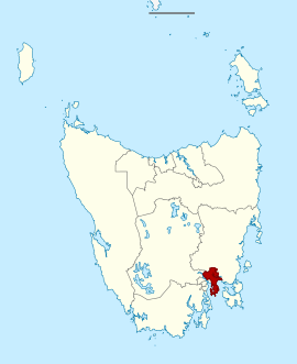
The Electoral division of Rumney is one of the 15 electorates or 'seats' in the Tasmanian Legislative Council (upper house). The division is located in Southern Tasmania to the east of the division of Pembroke.
The electorate is named after Mount Rumney in outer Hobart. The division covers an area of 434 km²[2] and includes a number of outer Hobart localities including; Lauderdale, Rokeby, Cambridge, Sorell, Richmond. It also includes a number of towns including; Port Arthur, Orford, Nubeena and Copping.
The division is held by Labor member Sarah Lovell.
There are currently 23,377[2] people enrolled to vote; the last election in Rumney was held on 6 May 2017. The next is scheduled for 2023.
Members
| Member | Party | Period | |
|---|---|---|---|
| Lin Thorp | Labor | 1999–2011 | |
| Tony Mulder | Independent | 2011–2017 | |
| Sarah Lovell | Labor | 2017–present | |
See also
References
- ↑ Legislative Council Divisions (2016-17 redistribution) from theLIST ©State of Tasmania (Creative Commons Attribution 3.0 Australia Licence).
- 1 2 "2017-17 Legislative Council Electoral Boundaries Redistribution" (PDF). lcredistribution.tas.gov.au. Legislative Council Electoral Boundaries Redistribution Tribunal. Retrieved 15 August 2017.
External links
Southern region of Tasmania, Australia | |||||
|---|---|---|---|---|---|
| City Other settlements | |||||
| Governance | |||||
| Mountains | |||||
| Protected areas, parks and reserves | |||||
| Rivers | |||||
| Harbours, bays, inlets and estuaries | |||||
| Coastal features | |||||
| Transport | |||||
| Landmarks |
| ||||
| Islands | |||||
| Books and newspapers | |||||
| Flora, fauna, and fishlife | |||||
| Bioregions | |||||
| Indigenous heritage | |||||
| Other | |||||
| |||||