Electoral district of Ringwood (Victoria)
| Ringwood Victoria—Legislative Assembly | |
|---|---|
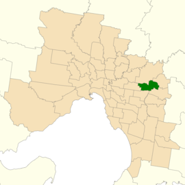 Location of Ringwood (dark green) in Greater Melbourne | |
| State | Victoria |
| Dates current | 1958–1992, 2014–present |
| MP | Dee Ryall |
| Party | Liberal |
| Namesake | Suburb of Ringwood |
| Electors | 40,419 (2014) |
| Area | 28 km2 (10.8 sq mi) |
| Demographic | Metropolitan |
The Electoral district of Ringwood is an electoral district of the Victorian Legislative Assembly. It was first proclaimed in 1958 and was abolished in 1992.[1] The electorate was located to the east of Melbourne and centred on the suburb of Ringwood, after which it is named.
Parts of Ringwood were included in the new Electoral district of Bayswater in 1992. Kay Setches, the last member for Ringwood, contested and lost Bayswater at the election that year.
Ringwood was created again at the 2013 redistribution of electoral boundaries that will take effect at the 2014 state election.[2] The new district largely replaces the abolished district of Mitcham, covering suburbs along the Maroondah Highway from Nunawading to Ringwood.[3]
The abolished district of Mitcham was held by Liberal MP Dee Ryall, who retained the new seat at the 2014 election.
Members
| First incarnation (1958–1992) | |||
|---|---|---|---|
| Member | Party | Term | |
| Jim Manson | Liberal | 1958–1973 | |
| Norman Lacy | Liberal | 1973–1976 | |
| Peter McArthur | Liberal | 1976–1982 | |
| Kay Setches | Labor | 1982–1992 | |
| Second incarnation (2014–present) | |||
|---|---|---|---|
| Member | Party | Term | |
| Dee Ryall | Liberal | 2014–present | |
Results
| Party | Candidate | Votes | % | ± | |
|---|---|---|---|---|---|
| Liberal | Dee Ryall | 17,440 | 48.1 | −1.6 | |
| Labor | Tony Clark | 11,777 | 32.5 | +0.7 | |
| Greens | Brendan Powell | 3,903 | 10.8 | −1.1 | |
| Independent | Michael Challinger | 1,440 | 4.0 | +4.0 | |
| Christians | Karen Dobby | 1,131 | 3.1 | +3.1 | |
| People Power Victoria | Steve Raskovy | 287 | 0.8 | +0.8 | |
| Country Alliance | Brian Dungey | 279 | 0.8 | +0.8 | |
| Total formal votes | 36,257 | 95.7 | −0.6 | ||
| Informal votes | 1,643 | 4.3 | +0.6 | ||
| Turnout | 37,900 | 93.8 | −1.1 | ||
| Two-party-preferred result | |||||
| Liberal | Dee Ryall | 19,919 | 55.1 | −1.2 | |
| Labor | Tony Clark | 16,250 | 44.9 | +1.2 | |
| Liberal hold | Swing | −1.2 | |||
References
- ↑ "Re-Member (Former Members)". State Government of Victoria. Retrieved 8 July 2013.
- ↑ "Summary of Changes". Victorian Electoral Boundary Commission. Archived from the original on 17 October 2013. Retrieved 17 October 2013.
- ↑ "Map of Ringwood District". Victorian Electoral Boundaries Commission.
- ↑ State Election 2014: Ringwood District, VEC.