Eggerding
| Eggerding | ||
|---|---|---|
 | ||
| ||
 Eggerding Location within Austria | ||
| Coordinates: 48°21′00″N 13°29′00″E / 48.35000°N 13.48333°ECoordinates: 48°21′00″N 13°29′00″E / 48.35000°N 13.48333°E | ||
| Country | Austria | |
| State | Upper Austria | |
| District | Schärding | |
| Government | ||
| • Mayor | Johann Hingsamer (ÖVP) | |
| Area | ||
| • Total | 22 km2 (8 sq mi) | |
| Elevation | 382 m (1,253 ft) | |
| Population (14 June 2016)[1] | ||
| • Total | 1,310 | |
| • Density | 60/km2 (150/sq mi) | |
| Time zone | UTC+1 (CET) | |
| • Summer (DST) | UTC+2 (CEST) | |
| Postal code | 4773 | |
| Area code | 07767 | |
| Vehicle registration | SD | |
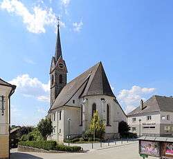
Eggerding is a municipality in the district of Schärding in the Austrian state of Upper Austria.
Geography
Eggerding lies in the Innviertel. About 10 percent of the municipality is forest, and 79 percent is farmland.
References
| Wikimedia Commons has media related to Eggerding. |
This article is issued from
Wikipedia.
The text is licensed under Creative Commons - Attribution - Sharealike.
Additional terms may apply for the media files.