Edinburgh–Dunblane line
| Edinburgh–Dunblane line | |
|---|---|
| Overview | |
| System | National Rail |
| Locale |
Edinburgh Falkirk Stirling Scotland |
| Operation | |
| Owner | National Rail |
| Technical | |
| Track gauge | 4 ft 8 1⁄2 in (1,435 mm) |
The Edinburgh–Dunblane line is a railway line in East Central Scotland. It links the city of Edinburgh via Falkirk to the city of Stirling, Lecropt (from Bridge of Allan) and the town of Dunblane. At Edinburgh Park this line joins the Edinburgh Crossrail line.
Service provision
Connections to other services
This line connects into other services in several locations:
- Dunblane – Highland Main Line
- Stirling – Croy Line
- Larbert – Croy Line
- Camelon – Cumbernauld Line
- Polmont – Glasgow–Edinburgh via Falkirk line
- Edinburgh Park – North Clyde Line
- Haymarket – Fife Circle Line, Edinburgh to Aberdeen Line, Shotts Line, West Coast Main Line
- Edinburgh Waverley – Borders Railway, North Berwick Line, East Coast Main Line
Provided by First ScotRail (from 2004 to 2015)
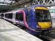
The services on this line were run by First ScotRail, now run by Abellio Scotrail. The vast majority of services are worked by Class 158 and Class 170 DMUs, with some services being provided by Class 156s. The Polmont–Dunblane section of the route is due to be electrified by 2018, when new EMUs will take over the operation of most services. This is part of the rolling programme of electrification in Scotland.
History
The route built in several stages:
- Edinburgh and Glasgow Railway between Edinburgh Waverley railway station and Haymarket in 1846.
- Edinburgh and Glasgow Railway between Haymarket and Polmont on 21 February 1842.
- Stirlingshire Midland Junction Railway between Polmont and Carmuirs / Larbert Junctions in 1850
- Scottish Central Railway between Carmuirs / Larbert Junctions and Dunblane in 1847
Electrification
The line is currently being electrified as part of the rolling programme of electrification in Scotland's Central Belt. [1] [2]
Sources
- Awdry, Christopher (1990). Encyclopaedia of British Railway Companies. Sparkford: Patrick Stephens Ltd. ISBN 1-8526-0049-7. OCLC 19514063. CN 8983.
- Jowett, Alan (March 1989). Jowett's Railway Atlas of Great Britain and Ireland: From Pre-Grouping to the Present Day (1st ed.). Sparkford: Patrick Stephens Ltd. ISBN 978-1-85260-086-0. OCLC 22311137.
- Jowett, Alan (2000). Jowett's Nationalised Railway Atlas (1st ed.). Penryn, Cornwall: Atlantic Transport Publishers. ISBN 978-0-906899-99-1. OCLC 228266687.
- Yonge, John (May 1987). Gerald Jacobs, ed. British Rail Track Diagams - Book 1: ScotRail (1st ed.). Exeter: Quail Map Company. ISBN 0-9006-0948-6.
- Yonge, John (February 1993). Gerald Jacobs, ed. Railway Track Diagams - Book 1: Scotland and the Isle of Man (2nd ed.). Exeter: Quail Map Company. ISBN 0-9006-0995-8.
- Yonge, John (April 1996). Gerald Jacobs, ed. Railway Track Diagams - Book 1: Scotland and the Isle of Man (3rd ed.). Exeter: Quail Map Company. ISBN 1-8983-1919-7.
- Yonge, John (2007). Gerald Jacobs, ed. Railway Track Diagams - Book 1: Scotland & Isle of Man (Quail Track Plans) (fifth ed.). Bradford on Avon: Trackmaps (formerly Quail Map Co). ISBN 978-0-9549866-3-6. OCLC 79435248.
References
- ↑ "Electrification programme". www.transport.gov.scot. Retrieved 2018-06-07.
- ↑ "Alloa line reopens after electrification works". www.railtechnologymagazine.com. Retrieved 2018-06-07.
External links
- Scottish Strategic Rail Study showing a Croy line map
|    | ||||||||||||||||||
|
| |||||||||||||||||||
| |||||||||||||||||||
| |||||||||||||||||||