Edgerton, Minnesota
| Edgerton, Minnesota | |
|---|---|
| City | |
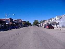 Downtown Edgerton, Minnesota | |
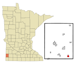 Location of Edgerton, Minnesota | |
| Coordinates: 43°52′31″N 96°7′56″W / 43.87528°N 96.13222°W | |
| Country | United States |
| State | Minnesota |
| County | Pipestone |
| Government | |
| • Type | Mayor – Council |
| • Mayor | Jason Snyder |
| Area[1] | |
| • Total | 1.16 sq mi (3.00 km2) |
| • Land | 1.16 sq mi (3.00 km2) |
| • Water | 0 sq mi (0 km2) |
| Elevation | 1,578 ft (481 m) |
| Population (2010)[2] | |
| • Total | 1,189 |
| • Estimate (2016)[3] | 1,132 |
| • Density | 1,000/sq mi (400/km2) |
| Time zone | UTC-6 (Central (CST)) |
| • Summer (DST) | UTC-5 (CDT) |
| ZIP code | 56128 |
| Area code(s) | 507 |
| FIPS code | 27-18152[4] |
| GNIS feature ID | 0643170[5] |
Edgerton is a city in Pipestone County, Minnesota, along the Rock River. The population was 1,189 at the 2010 census.[6]
History
Edgerton was platted in 1879, and named for Alonzo J. Edgerton, a Minnesota politician.[7] A post office has been in operation at Edgerton since 1879.[8] Edgerton was incorporated in 1887.[7]
Geography
According to the United States Census Bureau, the city has a total area of 1.16 square miles (3.00 km2), all of it land.[1]
Demographics
| Historical population | |||
|---|---|---|---|
| Census | Pop. | %± | |
| 1880 | 86 | — | |
| 1890 | 178 | 107.0% | |
| 1900 | 450 | 152.8% | |
| 1910 | 381 | −15.3% | |
| 1920 | 657 | 72.4% | |
| 1930 | 627 | −4.6% | |
| 1940 | 815 | 30.0% | |
| 1950 | 961 | 17.9% | |
| 1960 | 1,019 | 6.0% | |
| 1970 | 1,119 | 9.8% | |
| 1980 | 1,123 | 0.4% | |
| 1990 | 1,106 | −1.5% | |
| 2000 | 1,033 | −6.6% | |
| 2010 | 1,189 | 15.1% | |
| Est. 2016 | 1,132 | [3] | −4.8% |
| U.S. Decennial Census | |||
2010 census
As of the census[2] of 2010, there were 1,189 people, 491 households, and 322 families residing in the city. The population density was 1,025.0 inhabitants per square mile (395.8/km2). There were 525 housing units at an average density of 452.6 per square mile (174.7/km2). The racial makeup of the city was 95.3% White, 0.3% African American, 0.8% Asian, 2.1% from other races, and 1.5% from two or more races. Hispanic or Latino of any race were 3.6% of the population.
There were 491 households of which 26.5% had children under the age of 18 living with them, 60.3% were married couples living together, 3.1% had a female householder with no husband present, 2.2% had a male householder with no wife present, and 34.4% were non-families. 32.0% of all households were made up of individuals and 20.8% had someone living alone who was 65 years of age or older. The average household size was 2.30 and the average family size was 2.91.
The median age in the city was 46 years. 23.5% of residents were under the age of 18; 6% were between the ages of 18 and 24; 19.2% were from 25 to 44; 21.5% were from 45 to 64; and 29.9% were 65 years of age or older. The gender makeup of the city was 46.9% male and 53.1% female.
2000 census
As of the census[4] of 2000, there were 1,033 people, 435 households, and 287 families residing in the city. The population density was 890.2 people per square mile (343.8/km²). There were 477 housing units at an average density of 411.1 per square mile (158.8/km²). The racial makeup of the city was 98.84% White, 0.29% Asian, 0.87% from other races. Hispanic or Latino of any race were 0.68% of the population.
There were 435 households out of which 26.0% had children under the age of 18 living with them, 63.2% were married couples living together, 2.1% had a female householder with no husband present, and 33.8% were non-families. 32.9% of all households were made up of individuals and 25.5% had someone living alone who was 65 years of age or older. The average household size was 2.24 and the average family size was 2.85.
In the city, the population was spread out with 21.8% under the age of 18, 4.4% from 18 to 24, 17.9% from 25 to 44, 21.8% from 45 to 64, and 34.2% who were 65 years of age or older. The median age was 50 years. For every 100 females, there were 85.8 males. For every 100 females age 18 and over, there were 77.6 males.
The median income for a household in the city was $30,104, and the median income for a family was $39,318. Males had a median income of $30,968 versus $19,479 for females. The per capita income for the city was $15,517. About 2.7% of families and 4.9% of the population were below the poverty line, including 1.7% of those under age 18 and 10.3% of those age 65 or over.
Politics
Edgerton is located in Minnesota's 7th congressional district, represented by Collin Peterson, a Democrat. At the state level, Edgerton is located in Senate District 22, represented by Republican Doug Magnus, and in House District 22A, represented by Republican Joe Schomacker.
References
- 1 2 "US Gazetteer files 2010". United States Census Bureau. Archived from the original on 2012-01-24. Retrieved 2012-11-13.
- 1 2 "American FactFinder". United States Census Bureau. Retrieved 2012-11-13.
- 1 2 "Population and Housing Unit Estimates". Retrieved June 9, 2017.
- 1 2 "American FactFinder". United States Census Bureau. Archived from the original on 2013-09-11. Retrieved 2008-01-31.
- ↑ "US Board on Geographic Names". United States Geological Survey. 2007-10-25. Retrieved 2008-01-31.
- ↑ "2010 Census Redistricting Data (Public Law 94-171) Summary File". American FactFinder. United States Census Bureau. Archived from the original on 21 July 2011. Retrieved 27 April 2011.
- 1 2 Upham, Warren (1920). Minnesota Geographic Names: Their Origin and Historic Significance. Minnesota Historical Society. p. 417.
- ↑ "Pipestone County". Jim Forte Postal History. Retrieved 31 July 2015.
External links
Municipalities and communities of Pipestone County, Minnesota, United States | ||
|---|---|---|
| Cities |  | |
| Townships | ||
| Unincorporated communities | ||
| Footnotes | ‡This populated place also has portions in an adjacent county or counties | |
Coordinates: 43°52′21″N 96°07′43″W / 43.87250°N 96.12861°W