Edenvale, San Jose
| Edenvale | |
|---|---|
| Neighborhood of San Jose | |
.jpg) | |
 Edenvale | |
| Coordinates: 37°14′28″N 121°47′58″W / 37.24118°N 121.79932°WCoordinates: 37°14′28″N 121°47′58″W / 37.24118°N 121.79932°W | |
| Country |
|
| State | California |
| County | Santa Clara |
| City | San Jose |
| ZIP Code | 95111, 95123, 95136 |
| Area code(s) | Area code 408 |
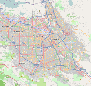
Edenvale is a neighborhood of San Jose, California, in South San Jose.
History


Edenvale was once a town, named with reference to the Garden of Eden, because of the beauty and fertility of the place.[1]
One of the oldest buildings in the area is Hayes Mansion. The Union Pacific Railroad and historic Monterey Road runs through the area, which is also known as El Camino Real. The railroad line carries Amtrak's "Coast Starlight."
The most popular recent history of the neighborhood includes Frontier Village, which was an amusement park operated from 1961 to 1980. Most of the land was redeveloped into residential housing.
Geography
It is one of the neighborhoods inside San Jose district 2.[2] The Blossom Valley and Santa Teresa areas are considered to be south of Edenvale, and the Seven Trees area is considered north of Edenvale.
Parks
.jpg)
Parks, libraries and other public areas of interest include:
- Hayes Mansion
- The Edenvale Public library at East Branham Lane and Monterey Road
- Edenvale Garden Park
- Great Oaks Park
- Danna Rock Park
- Coyote Creek Park
- Hellyer Lake Park near Highway 101
- Martial Cottle Park[3]
Education

The following are schools located in the Edenvale area:
- Valley Christian High School
- Caroline Davis Intermediate School
- Christopher Elementary School
- Stipe Elementary School
- Edenvale Elementary School
- Hayes Elementary School
- Andrew P. Hill High School
The public schools are in the Oak Grove School District (San Jose, California) and the East Side Union High School District.
External links
References
- ↑ Gannett, Henry (1905). The Origin of Certain Place Names in the United States. Govt. Print. Off. p. 114.
- ↑ http://www.sjdistrict2.com/?q=node/22
- ↑ http://www.parks.ca.gov/?page_id=24621