East Meath
| East Meath | |
|---|---|
| Area | |
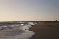 Bettystown Beach | |
| Country | Ireland |
| Province | Leinster |
| County | County Meath |
| Municipal district | Laytown-Bettystown |
| Dáil Éireann | Louth |
| EU Parliament | Midlands–North-West |
| Population (Census 2011) | |
| • Total | 20,375 |
| Time zone | UTC+0 (GMT (UTC)) |
| • Summer (DST) | UTC-1 (IST (WEST)) |
| Dialing code | +353 41 |
East Meath is an area of made up of the electoral divisions of St Mary's (Part) and Julianstown in County Meath. The area is bound on the north by the River Boyne and County Louth, to the south just beyond the River Nanny close to the County Dublin border, to the east by the Irish Sea and to the west by the M1. It has been part of the Dáil constituency of Louth since 2007.
Geography
Urban areas
- Bettystown
- Donacarney
- Southern environs of Drogheda
- Julianstown
- Laytown
- Mornington
Electoral divisions
- Julianstown
- St. Mary's (Part)
Demographics
The area has a population of 20,375 according to the 2011 census. The largest centre of population is the census town of Laytown-Bettystown-Mornington which had a population of 10,889 recorded in 2011.
Defined area
The Report on Dáil and European Parliament Constituencies 2007 recommended "that Louth should become a 5-seat constituency by extending the constituency southwards from, and in the environs of, Drogheda and taking in electoral divisions which have extensive linkages with the town. This will allow the inclusion of the town of Drogheda and hinterland areas in a single constituency."[1]
The Electoral (Amendment) Act 2009 defines the constituency as: "The county of Louth and, in the county of Meath, the electoral divisions of Julianstown, St. Mary’s (part), in the former Rural District of Meath."[2]
Sport
- St. Colmcille's GAA club serves the area of East Meath encompassing the villages of Laytown, Bettystown, Donacarney and Mornington. Their facilities are located at Páirc Uí Rís in Piltown, Bettystown.
- Laytown and Bettystown Golf Club, Golflinks Road, Bettystown.[3]
- Laytown and Bettystown Lawn Tennis Club, Golflinks Road, Bettystown.[4]
- East Meath United is a youths soccer football club that competes in the AUL, DDSL, DCSL and the NDSL. The football club, which was founded in 1999, plays its home matches at Minnistown Road, Laytown, County Meath. The teams colours are claret, Blue and White.[5]
Transport
Rail
Laytown Train Station serves the area with direct rail links to Dublin Connolly.
Road
East Meath can be reached via Exit 7 (Julianstown, Drogheda South), Exit 8 (Drogheda, Duleek) and Exit 9 (Drogheda Centre, Donore) on the M1 motorway which connects Dublin to Belfast.
East Meath can be reached via the R132 (Previously N1) by joining the R150 north in Drogheda, or R150 south in Julainstown.
Bus
Bus Éireann 190/190A connects Laytown-Drogheda-(Via Slane)-Navan-Trim/Athboy.
Matthews Coach Hire services East Meath with bus services to Dublin. The route serves, City North, Julianstown, Laytown, Bettystown, Donacarney and Drogheda Colpe.
Education
Primary
- Donacarney Boys National School.
- Gaelscoil an Bhradain Feasa, Drogheda.
- Le Cheile Educate Together National School, Drogheda.
- Reált Na Mara Girls National School, Donacarney.
- Scoil an Spiorad Naomh, Laytown.
- Scoil Oilibhéir Naofa, Laytown.
- Whitecross National School, Julianstown.
Secondary
Churches
Ecology
Sonairte is an interactive visitor centre established in 1986 which promotes ecological awareness and sustainable living. Sonairte, The Ninch, Laytown.[8]
Gallery
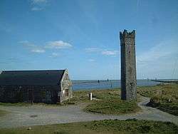 Maiden Tower, Mornington
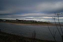 Laytown viewed from across the river Nanny
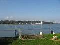 Ships on the Boyne at Mornington
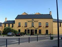 Neptune Hotel, Bettystown
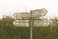 Bettystown road sign
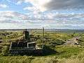 Mouth of the Boyne at Mornington
References
- ↑ http://www.constituency-commission.ie/docs%5Ccon2007.pdfThis%5Bpermanent+dead+link%5D
- ↑ http://www.irishstatutebook.ie/pdf/2009/en.act.2009.0004.pdf
- ↑ http://www.landb.ie/Default.aspx
- ↑ http://www.laytownbettystownltc.com
- ↑ https://sites.google.com/site/eastmeathutd/home
- ↑ "Archived copy". Archived from the original on 25 June 2014. Retrieved 25 June 2014.
- ↑ http://www.droghedapresbyterian.ie/
- ↑ http://sonairte.ie/