East Island (Andaman and Nicobar Islands)
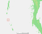
 East Island Location of East Island | |
| Geography | |
|---|---|
| Location | Bay of Bengal |
| Coordinates | 13°38′N 93°03′E / 13.64°N 93.05°ECoordinates: 13°38′N 93°03′E / 13.64°N 93.05°E |
| Archipelago | Andaman Islands |
| Adjacent bodies of water | Indian Ocean |
| Total islands | 1 |
| Major islands |
|
| Area | 3.10 km2 (1.20 sq mi)[1] |
| Length | 3.9 km (2.42 mi) |
| Width | 1.2 km (0.75 mi) |
| Coastline | 10.60 km (6.587 mi) |
| Highest elevation | 89 m (292 ft) |
| Administration | |
| District | North and Middle Andaman |
| Island group | Andaman Islands |
| Island sub-group | Cleugh Passage Group |
| Taluk | Diglipur Taluk |
| Largest settlement | East village (pop. 16) |
| Demographics | |
| Population | 16 (2016) |
| Pop. density | 5.16 /km2 (13.36 /sq mi) |
| Ethnic groups | Hindu, Andamanese |
| Additional information | |
| Time zone | |
| PIN | 744202[2] |
| Telephone code | 031927 [3] |
| ISO code | IN-AN-00[4] |
| Official website |
www |
| Literacy | 100.0% |
| Avg. summer temperature | 30.2 °C (86.4 °F) |
| Avg. winter temperature | 23.0 °C (73.4 °F) |
| Sex ratio | 15.0♂/♀ |
| Census Code | 35.639.0004 |
| Official Languages | Hindi, English |
East Island is an island of the Andaman Islands. It belongs to the North and Middle Andaman administrative district, part of the Indian union territory of Andaman and Nicobar Islands.[5] the island is lying 220 km (137 mi) north from Port Blair.
History
The island was severely affected by the tsunami that was caused by the 2004 Indian Ocean earthquake, which led to damaged infrastructure. East Island Lighthouse was established in 1969 and[6] is shown from a white, round metal tower with red bands standing on the South summit of the island; a recon is situated at the light. This lighthouse marks the northern end of the Andaman Islands.
Geography
The island falls in between Coco Islands and North Andaman Island. It belongs to the Cleugh Passage Group and lies immediately north of the passage. The island is small, having an area of 3.1 km2 (1.2 sq mi).
Administration
Politically, East Island, along neighboring Cleugh Passage Group Islands, is part of Diglipur Taluk.[7] The village is near the Police station.
Transportation
Ship service is available from Diglipur. Ship travel is only by special demand.
Demographics
There is only 1 village. According to the 2011 census of India, the Island has xxx households. The effective literacy rate (i.e. the literacy rate of population excluding children aged 6 and below) is 100%.[8]
| Total | Male | Female | |
|---|---|---|---|
| Population | 16 | 15 | 1 |
| Children aged below 6 years | 0 | 0 | 0 |
| Scheduled caste | 0 | 0 | 0 |
| Scheduled tribe | 16 | 15 | 1 |
| Literates | 16 | 15 | 1 |
| Workers (all) | 16 | 15 | 1 |
| Main workers (total) | 16 | 15 | 1 |
Image gallery
 Location of Car Nicobar island
References
- ↑ "Islandwise Area and Population - 2011 Census" (PDF). Government of Andaman.
- ↑ "A&N Islands - Pincodes". 2016-09-22. Archived from the original on 2014-03-23. Retrieved 2016-09-22.
- ↑ "STD Codes of Andaman and Nicobar". allcodesindia.in. Retrieved 2016-09-27.
- ↑ Registration Plate Numbers added to ISO Code
- ↑ "Village Code Directory: Andaman & Nicobar Islands" (PDF). Census of India. Retrieved 2011-01-16.
- ↑ "Government of India, Directorate General of Lighthouses and Lightships". www.dgll.nic.in. Retrieved 2016-10-18.
- ↑ Tehsils
- 1 2 "District Census Handbook - Andaman & Nicobar Islands" (PDF). 2011 Census of India. Directorate of Census Operations, Andaman & Nicobar Islands. Archived from the original (PDF) on 2015-08-01. Retrieved 2015-07-21.
- Geological Survey of India
