East Hibbard Township, Kearny County, Kansas
| East Hibbard Township | |
|---|---|
| Township | |
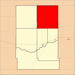 Location in Kearny County | |
| Coordinates: 38°10′12″N 101°12′46″W / 38.17000°N 101.21278°WCoordinates: 38°10′12″N 101°12′46″W / 38.17000°N 101.21278°W | |
| Country | United States |
| State | Kansas |
| County | Kearny |
| Area | |
| • Total | 155.58 sq mi (402.94 km2) |
| • Land | 155.58 sq mi (402.94 km2) |
| • Water | 0 sq mi (0 km2) 0% |
| Elevation | 3,192 ft (973 m) |
| Population (2000) | |
| • Total | 131 |
| • Density | 0.8/sq mi (0.3/km2) |
| GNIS feature ID | 0485249 |
East Hibbard Township is a township in Kearny County, Kansas, USA. As of the 2000 census, its population was 131.[1]
Geography
East Hibbard Township covers an area of 155.58 square miles (402.94 square kilometers).
Adjacent townships
- Valley Township, Scott County (northeast)
- Terry Township, Finney County (east)
- Sherlock Township, Finney County (southeast)
- Deerfield Township (south)
- Lakin Township (south)
- Hartland Township (southwest)
- West Hibbard Township (west)
- Leoti Township, Wichita County (northwest)
Major highways
Airports and landing strips
- Dienst Ranch Airport
References
External links
Municipalities and communities of Kearny County, Kansas, United States | ||
|---|---|---|
| Cities | 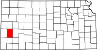 | |
| Townships | ||
This article is issued from
Wikipedia.
The text is licensed under Creative Commons - Attribution - Sharealike.
Additional terms may apply for the media files.