East Branch North Fork Feather River
| East Branch North Fork Feather River | |
| River | |
| Country | United States |
|---|---|
| State | California |
| Region | East Branch North Fork Feather Watershed |
| Source confluence | Indian & Spanish creeks |
| - elevation | 2,893 ft (882 m) [1][2] |
| Mouth | North Fork Feather River |
| - elevation | 2,274 ft (693 m) [3] |
| - coordinates | 40°00′51″N 121°13′32″W / 40.01417°N 121.22556°WCoordinates: 40°00′51″N 121°13′32″W / 40.01417°N 121.22556°W |
| Span between source and mouth |
12.98 mi (21 km), east-west (0.1879° great circle arc) |
| Basin | 1,010 sq mi (2,616 km2) [4] |
| Discharge | for North Fork Feather River |
| - average | 1,000 cu ft/s (28 m3/s) [5] |
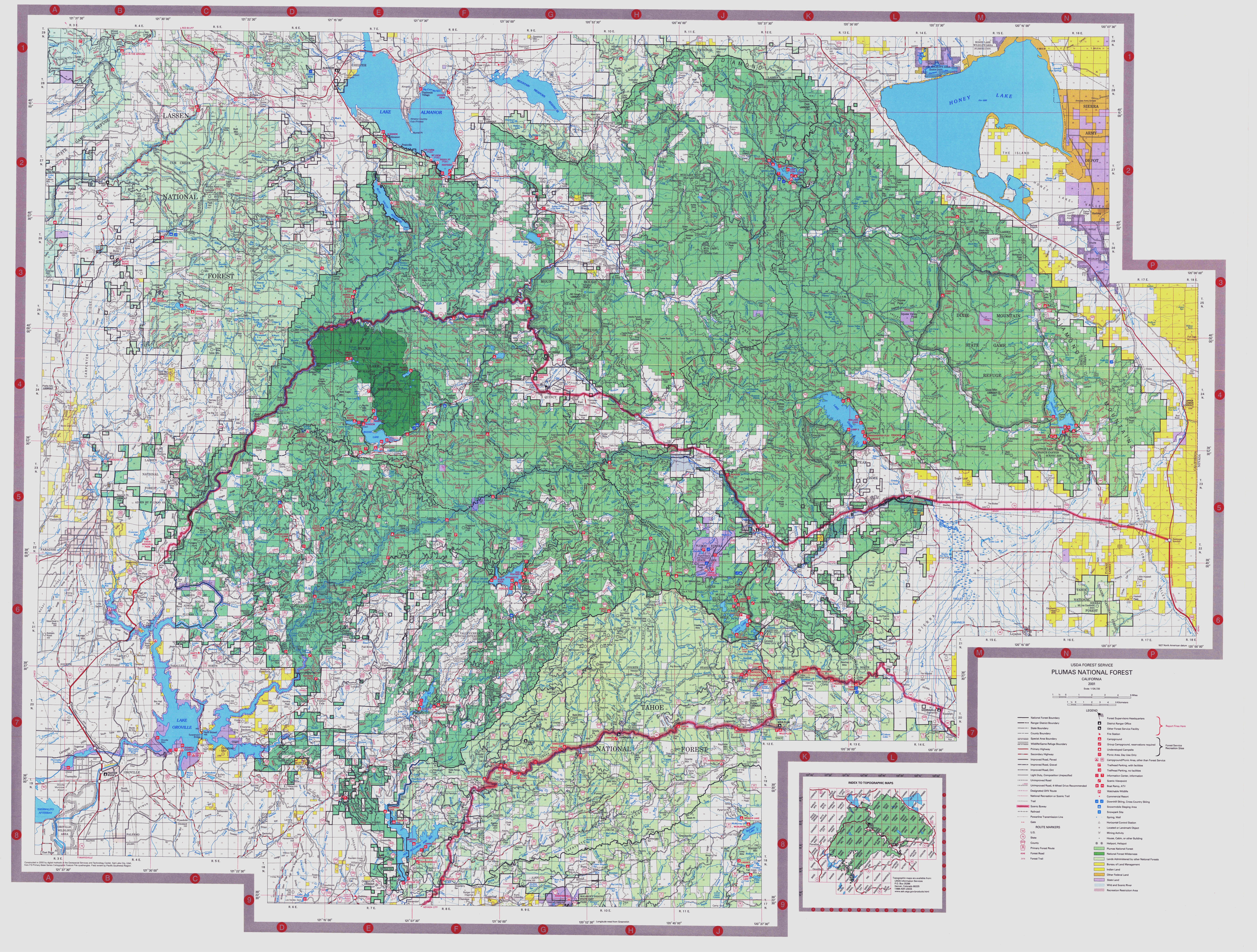
The East Branch North Fork Feather River is a left tributary of the North Fork Feather River in the northern Sierra Nevada, Plumas County, California. Primarily within the Plumas National Forest, its course extends past Twain to near Belden.[6]
Course landforms
- Triple watershed headwaters
The East Branch North Fork Feather River headwaters begin along ~46 mi (74 km) of the Sierra Crest from the triple watershed point with the North Fork (Bear Valley Creek headwaters) across Diamond Mountain (Indian Creek), Black Mountain, and the Middle Fork triple point.
- American Valley
The American Valley is a Sierra Nevada landform along Spanish Creek, a source tributary of the East Branch North Fork Feather River. Tributaries of Spanish Creek in the valley include Greenhorn Creek, and the valley has an elevation of ~3,410 feet (1,040 m) and population of ~6,500[7] (Quincy population is 1,950). Settlers drained the valley's wet meadows for cattle and hay production, and its stream channels are deeply incised (beavers were nearly eliminated).[6][8]
- Indian Valley
The Indian Valley is an alluvial valley of the East Branch North Fork Feather Watershed along lower Indian Creek. Communities in Indian Valley include Greenville and Taylorsville. In 1946, California's Division of Water Resources issued the Report on Water Supply and Use of Water on Indian Creek Stream System.
See also
- Index: Tributaries of the Feather River
References
- ↑ "USGS National Map Viewer". Archived from the original on 2012-04-05. Retrieved 2012-07-26.
- ↑ "USGS Elevation Web Service Query". United States Geological Survey. Archived from the original on 2010-05-27. Retrieved 2010-02-19.
- ↑ "East Branch North Fork Feather River". Geographic Names Information System. United States Geological Survey.
- ↑ "Boundary Descriptions and Names of Regions, Subregions, Accounting Units and Cataloging Units". USGS.gov. Retrieved 2010-08-22.
- ↑ Wills, Leah. "Upper Feather River Integrated Regional Water Management Plan" (PDF). Plumas County. Archived from the original (PDF) on 2 September 2011. Retrieved 4 August 2010.
- 1 2 "Plumas National Forest map". Retrieved 2010-08-22.
- ↑ Holly George, David Lile, Cheree Childers, Cindy Noble, Andrea Oilar, Katherine Haworth, Kristen Schmidt, and Gabe Miller (March 2007). "Upper Feather River Watershed (UFRW) Irrigation Discharge Management Program" (PDF). University of California Division of Agriculture and Natural Resouces.
- ↑ George, Holly; et al. "Upper Feather River Watershed (UFRW) Irrigation Discharge Management Program" (PDF). University of California. Archived from the original (PDF) on 2010-06-12. Retrieved 2010-09-08.
Two main watercourses, Spanish Creek and Greenhorn Creek, run through the [American] valley. They converge at the end of the valley and the combined flow merges further downstream with Indian Creek to form part of the East Branch of the North Fork of the Feather River.
(p. 19)