Earlington Heights station
| |||||||||||||||
|---|---|---|---|---|---|---|---|---|---|---|---|---|---|---|---|
| Metrorail metro station | |||||||||||||||
 The Airport Expressway and Allapattah, as seen from the station platform | |||||||||||||||
| Location |
2100 NW 41st Street Miami, Florida | ||||||||||||||
| Coordinates | 25°48′45″N 80°13′48″W / 25.81250°N 80.23000°WCoordinates: 25°48′45″N 80°13′48″W / 25.81250°N 80.23000°W | ||||||||||||||
| Owned by | Miami-Dade County | ||||||||||||||
| Line(s) | |||||||||||||||
| Platforms | 1 island platform | ||||||||||||||
| Tracks | 2 | ||||||||||||||
| Connections |
| ||||||||||||||
| Construction | |||||||||||||||
| Parking | Garage (95 spaces) | ||||||||||||||
| Disabled access | Yes | ||||||||||||||
| Other information | |||||||||||||||
| Station code | EHT | ||||||||||||||
| History | |||||||||||||||
| Opened | December 17, 1984 | ||||||||||||||
| Traffic | |||||||||||||||
| Passengers (2011) |
456,000[1] | ||||||||||||||
| Services | |||||||||||||||
| |||||||||||||||
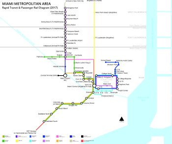
Earlington Heights station is a station on the Metrorail rapid transit system in the unincorporated community of Brownsville in Miami-Dade County, Florida. This station is located at the intersection of Northwest 21st Avenue and the Airport Expressway (SR 112). The Metrorail Orange Line creation and extension of the metro to Miami International Airport (MIA) began construction from this rail station in May 2009, completed in July 2012. Passenger service between MIA, through Downtown Miami, and to the southern Miami suburb of Kendall opened in Summer 2012.
Station layout

Signige indicating Orange Line transfer
| P Platform level |
Southbound | ← Green Line, Orange Line toward Dadeland South (Allapattah) |
| Island platform, doors will open on the left | ||
| Northbound | Green Line toward Palmetto (Brownsville) → Orange Line toward Miami Airport (Terminus) → | |
| G | Street level | Exit/entrance and buses |
Places of interest
- Miami International Airport (via the Orange Line)
- Brownsville
- Allapattah
- Historic Miami Jackson High School
- Earlington Heights Elementary
References
External links

- MDT – Metrorail Stations
- entrance from Google Maps Street View
This article is issued from
Wikipedia.
The text is licensed under Creative Commons - Attribution - Sharealike.
Additional terms may apply for the media files.