Coconut Grove station
| |||||||||||||||
|---|---|---|---|---|---|---|---|---|---|---|---|---|---|---|---|
| Metrorail metro station | |||||||||||||||
 Center Coconut Grove, as seen from the station | |||||||||||||||
| Location |
2780 SW 27th Avenue Miami, Florida | ||||||||||||||
| Coordinates | 25°44′23″N 80°14′19″W / 25.73972°N 80.23861°WCoordinates: 25°44′23″N 80°14′19″W / 25.73972°N 80.23861°W | ||||||||||||||
| Owned by | Miami-Dade County | ||||||||||||||
| Line(s) | |||||||||||||||
| Platforms | 1 island platform | ||||||||||||||
| Tracks | 2 | ||||||||||||||
| Connections |
| ||||||||||||||
| Construction | |||||||||||||||
| Parking | Park and ride (204 spaces) | ||||||||||||||
| Disabled access | Yes | ||||||||||||||
| Other information | |||||||||||||||
| Station code | CGV | ||||||||||||||
| History | |||||||||||||||
| Opened | May 20, 1984 | ||||||||||||||
| Traffic | |||||||||||||||
| Passengers (2011) |
550,000[1] | ||||||||||||||
| Services | |||||||||||||||
| |||||||||||||||
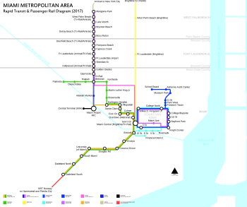
Coconut Grove station is a station on the Metrorail rapid transit system on the western end of the Coconut Grove neighborhood of Miami, Florida. The station is located at the intersection of South Dixie Highway (US 1) and West 27th Avenue/Grapeland Boulevard (SR 9), opening to service May 20, 1984.
Station layout
| P Platform level |
Southbound | ← Downtown Express does not stop here ← Green Line, Orange Line toward Dadeland South (Douglas Road) |
| Island platform, doors will open on the left | ||
| Northbound | Green Line toward Palmetto (Vizcaya) → Orange Line toward Miami Airport (Vizcaya) → Downtown Express does not stop here → | |
| G | Street level | Exit/entrance, buses, parking |
References
External links
This article is issued from
Wikipedia.
The text is licensed under Creative Commons - Attribution - Sharealike.
Additional terms may apply for the media files.