Eagle Rock, Virginia
| Eagle Rock, Virginia | |
|---|---|
| Unincorporated community | |
 Location of Eagle Rock in Virginia  Eagle Rock, Virginia (the US) | |
| Coordinates: 37°38′26″N 79°48′04″W / 37.64056°N 79.80111°WCoordinates: 37°38′26″N 79°48′04″W / 37.64056°N 79.80111°W | |
| Country | United States |
| State | Virginia |
| County | Botetourt |
| Elevation[1] | 971 ft (296 m) |
| Time zone | UTC-5 (Eastern (EST)) |
| • Summer (DST) | UTC-4 (EDT) |
| ZIP code | 24085 |
| Area code(s) | 540 |
| FIPS code | 51-51023 |
| GNIS feature ID | 1494212[1] |
| Other names |
Breckenridge, Eagle Mountain, Eaglerock, Rat Hole Sheets[1] |
| [2] | |
Eagle Rock is an unincorporated community in Botetourt County, Virginia, United States, located along the James River between Iron Gate and Buchanan.
History
Eagle Rock had the last lock of the James River and Kanawha Canal.[3]
Lime production
It was the location of the kilns for making lime. Limestone was transported across the river via a tram system and then burned in the kilns to make lime. Old quarries and locally known Quarry Hill are located on either side of US 220. The Bessemer Archaeological Site, Phoenix Bridge and Roaring Run Furnace are listed on the National Register of Historic Places.[4]
Rail history
At the end of the canal system, transportation was done by rail. Eagle Rock was the point of convergence of the Richmond and Alleghany Railroad (soon to be known as the Chesapeake and Ohio Railway, and later CSX Transportation) and the Craig Valley Line, which ran to Surber Station and on to New Castle, Virginia.
Education
The town is served by Botetourt County Public Schools. The town had its own high school until the late 1950s, when the Northern Botetourt high schools were all consolidated into the newly formed James River High School in neighboring Springwood. All public school students in Eagle Rock attend Eagle Rock Elementary, Central Academy Middle, and James River High.
Notable residents
- William Hanes Ayres (1916–2000), U.S. Congressman from Ohio, was born in Eagle Rock,[5]
- Norvel Lee, (1924-1992) Olympic Boxer who represented the United States at the 1952 Summer Olympics in Helsinki.
- Angela Tincher, All-American softball pitcher for James River High School and Virginia Tech.
References
- 1 2 3 U.S. Geological Survey Geographic Names Information System: Eagle Rock, Virginia. Retrieved on 2008-06-19.
- ↑ "ZIP Code Lookup". Retrieved 2008-06-20.
- ↑ Sutcliffe, Andrea (2010). Touring the Shenandoah Valley backroads (2nd ed.). Winston-Salem, N.C.: John F. Blair Publishers. p. 257. ISBN 9780895873934. Retrieved 11 June 2016.
- ↑ National Park Service (2010-07-09). "National Register Information System". National Register of Historic Places. National Park Service.
- ↑ United States Congress. "William Hanes Ayres (id: A000229)". Biographical Directory of the United States Congress. . Retrieved on 2008-06-20.
External links
- Down Home in Eagle Rock by Anita J. Firebaugh, Cooperative Living magazine, February 2000
- Eagle Rock Myspace
Municipalities and communities of Botetourt County, Virginia, United States | ||
|---|---|---|
| Towns | 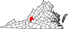 | |
| CDPs | ||
| Unincorporated communities |
| |
| Footnotes | ‡This populated place also has portions in an adjacent county or counties | |