Dyrøya, Øksnes
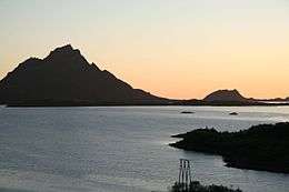 Dyrøya is on the left (with the tall mountain) | |
 Dyrøya | |
| Geography | |
|---|---|
| Location | Øksnes, Nordland, Norway |
| Coordinates | 68°48′37″N 14°49′34″E / 68.8102°N 14.8260°ECoordinates: 68°48′37″N 14°49′34″E / 68.8102°N 14.8260°E |
| Area | 6.5 km2 (2.5 sq mi) |
| Length | 4 km (2.5 mi) |
| Width | 2.8 km (1.74 mi) |
| Highest elevation | 562 m (1,844 ft) |
| Highest point | Blåtinden |
| Administration | |
| County | Nordland |
| Municipality | Øksnes |
Dyrøya is a small island in the municipality of Øksnes in Nordland county, Norway. It is located off the west coast of the large island of Langøya in the Vesterålen archipelago. The small islands of Nærøya and Tindsøya lie to the west and the island of Skogsøya lies to the north. The 6.5-square-kilometre (2.5 sq mi) island has one village, Barkestad. There are no road connections to the island, so all residents must use boats.[1]
References
- ↑ Store norske leksikon. "Dyrøya – øy i Øksnes" (in Norwegian). Retrieved 2012-07-31.
This article is issued from
Wikipedia.
The text is licensed under Creative Commons - Attribution - Sharealike.
Additional terms may apply for the media files.