Dynamite, Washington
| Dynamite | |
|---|---|
| Unincorporated community | |
 Dynamite Location within the state of Washington | |
| Coordinates: 47°29′46″N 117°27′4″W / 47.49611°N 117.45111°WCoordinates: 47°29′46″N 117°27′4″W / 47.49611°N 117.45111°W | |
| Country | United States |
| State | Washington |
| County | Spokane |
| Elevation | 2,333 ft (711 m) |
| Time zone | UTC-8 (Pacific (PST)) |
| • Summer (DST) | UTC-7 (PDT) |
| GNIS feature ID | 1510923[1] |
Dynamite is a small unincorporated community in Spokane County, Washington, United States. The elevation of Dynamite is 2,333 feet. Dynamite appears on the Spangle West U.S. Geological Survey Map. Spokane County is in the Pacific Time Zone (UTC-8 hours).
References
Municipalities and communities of Spokane County, Washington, United States | ||
|---|---|---|
| Cities | 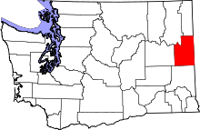 | |
| Towns | ||
| CDPs | ||
| Unincorporated communities | ||
| Ghost towns | ||
This article is issued from
Wikipedia.
The text is licensed under Creative Commons - Attribution - Sharealike.
Additional terms may apply for the media files.