Duff Islands
The Duff Islands are a small island group lying to the northeast of the Santa Cruz Islands in the Solomon Islands province of Temotu. They are also sometimes known as the Wilson Islands.
.png)
.jpg)
Location and geography
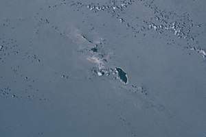
The islands are located at 9°51'48" S. lat., 167°4'48" E. long.
The Duff Islands consist of:
- Taumako, the main island, with nearby Tahua, Tohua, and Tatumotu
- The Bass Islands: Lua, Kaa and Loreva
- Treasurer's Islands: Tuleki (Nula), Elingi (Obelisk Island), Te Aku (Te Ako), Lakao and Ulaka
Frequently, Hallie Jackson Reef is mentioned in the context of the Duff islands, although it is located 45 km west of the 32 km long island chain, and although it is no island, but at most a submarine reef. In the Sailing Directions of 1969 Hallie Jackson Reef is described as a reef 24 feet deep, at 9°44'S, 166°07'E.[1] The corresponding current (2010) publication has no mention of the reef anymore.[2]
Local population
The Duff Islands were settled by the Lapita people about 900 BC. They were followed by Melanesians and then Polynesians in the mid 1400's.[3] The modern inhabitants of the Duff Islands are Polynesians, and their language, Pileni, is a member of the Samoic branch of Polynesian languages. On the islands of Duff live about 500 people. The way of life is traditional by subsistence farming and fishing. Taumako has no roads, airport, telephones, or electricity. Contact with outsiders comes by battery-powered marine radio and the occasional cargo ship.
Discovery
The first recorded sighting by Europeans of the Duff Islands was by the Spanish expedition of Pedro Fernández de Quirós where it anchored on 8 April 1606. Its inhabitants named the islands as Taumako. They were charted by Quirós as Nuestra Señora del Socorro (Our Lady of Succour in Spanish).[4][5][6]
The Duff Islands were named after missionary ship Duff, captained by James Wilson, which reached them in 1797.
Traditional navigation
Studies of David Lewis and Marianne (Mimi) George uncovered that full traditional Polynesian navigational technique is still preserved in these islands (Finney and Lowe, 2006, p163).
See also
References
- Duff Islands, Solomon Islands, solomonislands.com.sb
- Ben Finney and Sam Low, "Navigation", in K.R.Howe(eds), "Vaka Moana:Voyages of the Ancestors", Bateman, 2007. ISBN 978-0-8248-3213-1
- Specific
- ↑ Hydrographer of the Navy, Pacific Islands Pilot Vol. II, 1969, Seite 254
- ↑ Pacific Islands, Pub. 126, Sailing Directions (Enroute) for Pacific Islands, Twelfth Edition, 2017
- ↑ "Duff Islands - John Seach". Volcano Live. Retrieved 30 July 2018.
- ↑ Sharp, Andrew The discovery of the Pacific Islands Oxford, 1960, p.61.
- ↑ Brand, Donald D. The Pacific Basin: A History of its Geographical Explorations The American Geographical Society, New York, 1967, p.137.
- ↑ Kelly, Celsus, O.F.M. La Austrialia del Espiritu Santo. The Journal of Fray Martín de Munilla O.F.M. and other documents relating to the Voyage of Pedro Fernández de Quirós to the South Sea (1605-1606) and the Franciscan Missionary Plan (1617-1627) Cambridge, 1966, p.39,62.
External links
Coordinates: 9°48′00″S 167°06′00″E / 9.800°S 167.10°E