Ducey
| Ducey | |
|---|---|
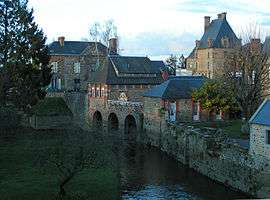 The Sélune at Ducey | |
 Ducey Location within Normandy region  Ducey | |
| Coordinates: 48°37′12″N 1°17′17″W / 48.62°N 1.2881°WCoordinates: 48°37′12″N 1°17′17″W / 48.62°N 1.2881°W | |
| Country | France |
| Region | Normandy |
| Department | Manche |
| Arrondissement | Avranches |
| Canton | Pontorson |
| Intercommunality | Avranches - Mont-Saint-Michel |
| Government | |
| • Mayor | Denis Laporte[1] |
| Area1 | 11.21 km2 (4.33 sq mi) |
| Population (2012)2 | 2,485 |
| • Density | 220/km2 (570/sq mi) |
| Demonym(s) | Ducéens |
| Time zone | UTC+1 (CET) |
| • Summer (DST) | UTC+2 (CEST) |
| INSEE/Postal code | 50168 /50220 |
| Elevation |
6–113 m (20–371 ft) (avg. 15 m or 49 ft) |
|
1 French Land Register data, which excludes lakes, ponds, glaciers > 1 km2 (0.386 sq mi or 247 acres) and river estuaries. 2 Population without double counting: residents of multiple communes (e.g., students and military personnel) only counted once. | |
Ducey is a former commune in the Manche department in north-western France. On 1 January 2016, it was merged into the new commune of Ducey-les-Chéris.[2] It is noted for its old bridge dating from 1613, which allowed pilgrims to cross the Sélune on the way to Mont Saint-Michel.[3]
Heraldry
 |
The arms of Ducey are blazoned : Quarterly 1&4: Gules, 3 escallops Or; 2&3: Azure, 3 fleurs de lys Or. |
See also
References
- ↑ "Deliberations du Conseil Municipal de Ducey" (PDF) (in French). City Council of Ducey. 14 January 2016. Retrieved 5 March 2016.
- ↑ Arrêté préfectoral 25 November 2015 (in French)
- ↑ "Ducey History". Office de Tourisme de Ducey. Retrieved 4 March 2016.
| Wikimedia Commons has media related to Ducey. |
This article is issued from
Wikipedia.
The text is licensed under Creative Commons - Attribution - Sharealike.
Additional terms may apply for the media files.