Downton, Hampshire
| Downton | |
|---|---|
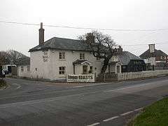 Downton, The Royal Oak | |
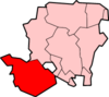
 Downton Downton shown within Hampshire | |
| OS grid reference | SZ2693 |
| Civil parish | |
| District | |
| Shire county | |
| Region | |
| Country | England |
| Sovereign state | United Kingdom |
| Post town | LYMINGTON |
| Postcode district | SO41 |
| Police | Hampshire |
| Fire | Hampshire |
| Ambulance | South Central |
| EU Parliament | South East England |
| UK Parliament | |
Downton is a coastal hamlet in Hampshire, England situated - mostly - around a crossroads on the A337 road where the road from Lymington to New Milton intersects with the road from the original settlement of Hordle northwards. It has its own beach favoured by naturists below Hordle cliffs which has become inaccessible due to coastal erosion. Its mostly in the parish of Hordle, although most of the population live in the part that is in the parish of Milford (where according to the Post Office the majority of the population at the 2011 Census was included). Part of the Green belt, its population is static.[1]
History
Downton is first mentioned in the Pipe rolls for 1160 as a 'new place'.[2] The name is first recorded as Dunchinton although more commonly Donketon and Coates states that this is most likely derived from Dunneca's farm or otherwise from *OE dunnocatu-n (farm of hedge sparrows).[3] In 1263 the estate seems to have belonged to Thomas de Orweye although, by 1397, it had expanded to include part of Everton in Milford.[4] After c. 1500 the manor became part of the extensive possessions of the Milles family of Southampton, builders of Hurst Castle. The manor was purchased at end of the 18th century by Sir William Cornwallis (with adjoining manors in Milford) whose heir, Anne Whitby was the grandmother of Col. William Cornwallis-West.[4] His son George Cornwallis-West went bankrupt around 1920 and the estate was sold. The western part, owned by the Ashley Clinton family, was sold a few years later although the planned large scale development was prevented.
Piecemeal house building followed for the next few decades. Before the 1980s, the A337 road west of Downton made six sharp turns,[5] but the road has since been straightened.
The region has always been one of dispersed settlement although, with its forge and the inn known as The Royal Oak,[4] Downton provided one centre for the provision of services in Hordle. Whilst the inn remains, today the adjacent businesses are car-related. In 2009 permission was granted for gravel extraction on a nearby site, despite opposition from local residents.[6]
References
- ↑ Hordle, Imperial Gazetteer of England and Wales, 1870-72, at visionofbritain.org
- ↑ Pipe Rolls 11 Henry II
- ↑ R. Coates, Place names of Hampshire, 19
- 1 2 3 "Hordle". A History of the County of Hampshire: Volume 5 (1912). Retrieved 2010-12-27.
- ↑ See the 1940s Ordnance Survey Popular Edition map for an example of the old road layout
- ↑ Group gives up fight to stop gravel pit bid, Southern Daily Echo, 13 December 2009
| Wikimedia Commons has media related to Downton, Hampshire. |