Douradina, Mato Grosso do Sul
| Douradina | ||
|---|---|---|
| Municipality | ||
| ||
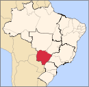
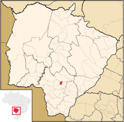 Location in Mato Grosso do Sul and Brazil | ||
| Coordinates: 22°2′24″S 54°34′46″W / 22.04000°S 54.57944°WCoordinates: 22°2′24″S 54°34′46″W / 22.04000°S 54.57944°W | ||
| Country |
| |
| State |
| |
| Region | Center-West | |
| Microregion | Dourados | |
| Government | ||
| • Mayor | Nair Branti | |
| Area | ||
| • Total | 281 km2 (108 sq mi) | |
| Elevation | 553 m (1,814 ft) | |
| Population (2007) | ||
| • Total | 4,900 | |
| • Density | 17/km2 (45/sq mi) | |
| Time zone | UTC-4 (UTC-4) | |
| • Summer (DST) | UTC-3 (UTC-3) | |
| Area code(s) | +55 67 | |
| Website | www.douradina.ms.gov.br | |

Douradina is a municipality located in the Brazilian state of Mato Grosso do Sul. Its population was 4,726 (2005) and its area is 281 km²,[1] which makes it the smallest municipality in the state.
References
- ↑ IBGE - "Archived copy". Archived from the original on 2007-01-09. Retrieved 2014-08-03.
Capital: Campo Grande | |||||||||
| Mesoregion Centro Norte de Mato Grosso do Sul |
|  | |||||||
| Mesoregion Leste de Mato Grosso do Sul |
| ||||||||
| Mesoregion Pantanal Sul Mato-Grossense |
| ||||||||
| Mesoregion Sudoeste de Mato Grosso do Sul |
| ||||||||
This article is issued from
Wikipedia.
The text is licensed under Creative Commons - Attribution - Sharealike.
Additional terms may apply for the media files.