Douglas, Northern Cape
| Douglas | |
|---|---|
 Douglas suburbia | |
 Douglas  Douglas Douglas (South Africa)  Douglas Douglas (Africa) | |
| Coordinates: 29°03′S 23°46′E / 29.050°S 23.767°ECoordinates: 29°03′S 23°46′E / 29.050°S 23.767°E | |
| Country | South Africa |
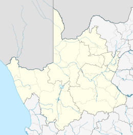
| Province | Northern Cape |
| District | Pixley ka Seme |
| Municipality | Siyancuma |
| Established | 1867 |
| Area[1] | |
| • Total | 86.42 km2 (33.37 sq mi) |
| Elevation | 990 m (3,250 ft) |
| Population (2011)[1] | |
| • Total | 20,083 |
| • Density | 230/km2 (600/sq mi) |
| Racial makeup (2011)[1] | |
| • Black African | 32.1% |
| • Coloured | 58.3% |
| • Indian/Asian | 0.8% |
| • White | 8.0% |
| • Other | 0.9% |
| First languages (2011)[1] | |
| • Afrikaans | 93.1% |
| • Tswana | 2.3% |
| • English | 1.5% |
| • Other | 3.1% |
| Time zone | UTC+2 (SAST) |
| Postal code (street) | 8730 |
| PO box | 8730 |
| Area code | 053 |
Douglas is an agricultural and stock farming town situated near the confluence of the Orange and Vaal Rivers in the Northern Cape province of South Africa. Notably the rural town has a diverse population, with mostly state institutions and the anchor private employer, GWK, an agricultural company.
Location
Douglas lies about 100km southwest of Kimberley the capital of the Northern Cape. These two are connected by the R357 road.
History
The town was founded in 1848 as a mission station on the farm Backhouse by the Reverend Isaac Hughes. In 1867, a group of Europeans from Griquatown signed an agreement giving them the right to establish a town. The town was named after General Sir Percy Douglas, Lieutenant Governor of the Cape Colony.
Notable people from Douglas
- Ingrid Jonker, poet
- Hannes Nienaber, well-known sports journalist
References
- 1 2 3 4 "Main Place Douglas". Census 2011.
This article is issued from
Wikipedia.
The text is licensed under Creative Commons - Attribution - Sharealike.
Additional terms may apply for the media files.