Dothan (ancient city)
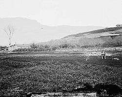

Dothan (Hebrew: דֹתָן) (also Dotan) was a biblical city located north of Shechem, about 100 km north of Hebron. Eusebius places it 12 miles to the north of Sebaste (Samaria).[1] It has been identified with Tel Dothan located ten kilometers (driving distance) southwest of the Palestinian city of Jenin, near Dotan Junction of Route 60.[2][3][4]
History
Dothan is first mentioned in the Hebrew Bible (Genesis 37:17) in connection with the history of Joseph, as the place where Jacob (Israel's) sons had moved their sheep and where, at the suggestion of Judah, the brothers sold Joseph to the Ishmaelite merchants (Gen. 37:17). It later appears as the residence of Elisha (2 Kings 6:13) and the scene of a vision of chariots and horses of fire surrounding the mountain on which the city stood.[5] The city served as an Israelite administrative center during this period and archaeology has discovered a large complex and Hebrew inscriptions from the site.[6][7]
The Israeli settlement of Mevo Dotan (lit. Approach to Dothan) is named for the city, as is Dothan, Alabama.
See also
References
- ↑ Eusebius of Caesarea, Onomasticon (1971), Notes edited by. C. Umhau Wolf under "Merran", accessed 27 December 2017
- ↑ Daniel M. Master; John Monson. "Tel Dothan 2002 Overview". Harvard University: Faculty of arts and Sciences. Archived from the original on 2010-07-04. Retrieved 2011-07-24.
- ↑ "Tel Dothan (photo and map)". panoramio.com. Retrieved 2011-07-24.
- ↑ Robinson, Edward, Biblical Researches in Palestine and the Adjacent Regions (Boston: 1860), vol. ii, page 419.
- ↑ 2 Kings 6:17
- ↑ Master, Monson, Lass and Peirce. (2005). Dothan I: Remains from the Tell (1953-1964). Winona Lake: Eisenbrauns.
- ↑ Miglio (2014). "Epigraphic Artifacts from Tell Dothan". BASOR.
Bibliography
- Conder, C.R. (1878). Tent work in Palestine. A record of discovery and adventure. 1. Internet.archive (from Harvard collection). (pp. 116 -117)
- Conder, C.R.; Kitchener, H.H. (1882). The Survey of Western Palestine: Memoirs of the Topography, Orography, Hydrography, and Archaeology. 2. London: Committee of the Palestine Exploration Fund. (p. 215)
- Guérin, V. (1875). Description Géographique Historique et Archéologique de la Palestine (in French). 2: Samarie, pt. 2. Paris: L'Imprimerie Nationale. (pp. 219-222)
- Maundrell, H. (1703). A Journey from Aleppo to Jerusalem: At Easter, A. D. 1697. Oxford: Printed at the Theatre. (p. 57)
- Palmer, E.H. (1881). The Survey of Western Palestine: Arabic and English Name Lists Collected During the Survey by Lieutenants Conder and Kitchener, R. E. Transliterated and Explained by E.H. Palmer. Committee of the Palestine Exploration Fund. (p. 194)
- Robinson, E.; Smith, E. (1841). Biblical Researches in Palestine, Mount Sinai and Arabia Petraea: A Journal of Travels in the year 1838. 3. Boston: Crocker & Brewster. (pp. 316 - 317)
- Zertal, A. (2004). The Manasseh Hill Country Survey. 1. Boston: BRILL. ISBN 9004137564. (pp. 149-150)
Coordinates: 32°24′48.70″N 35°14′23.50″E / 32.4135278°N 35.2398611°E
External links
- Survey of Western Palestine, Map 11: IAA, Wikimedia commons
- Dothan: Remains from the tel (1953-1964), Daniel M. Master