Dolní Přím
| Dolní Přím | |||
| Village | |||
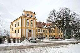 Chateau in Dolní Přím | |||
|
|||
| Country | Czech Republic | ||
|---|---|---|---|
| Region | Hradec Králové | ||
| District | Hradec Králové | ||
| Commune | Hradec Králové | ||
| Elevation | 284 m (932 ft) | ||
| Coordinates | 50°14′24″N 15°42′21″E / 50.24000°N 15.70583°ECoordinates: 50°14′24″N 15°42′21″E / 50.24000°N 15.70583°E | ||
| Area | 10.83 km2 (4.18 sq mi) | ||
| Population | 636 (1. 1. 2012) | ||
| Density | 59/km2 (153/sq mi) | ||
| First mentioned | 1352 | ||
| Mayor | Petr Švasta | ||
| Timezone | CET (UTC+1) | ||
| - summer (DST) | CEST (UTC+2) | ||
| Postal code | 503 16 | ||
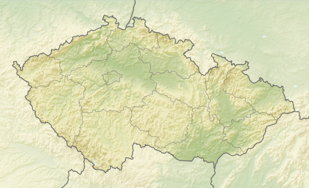 Location in the Czech Republic | |||
| Wikimedia Commons: Dolní Přím | |||
| Statistics: statnisprava.cz | |||
| Website: www.dolni-prim.cz | |||


Dolní Přím is a village in the Czech Republic located about 10 km west of Hradec Králové.
As Nieder Prim (Lower Prim) in Bohemia it was a site of the Battle of Königgrätz in 1866, together with nearby Problus (Probluz).
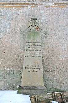
Memorial to the fallen of 1866
External links

- Municipal website
This article is issued from
Wikipedia.
The text is licensed under Creative Commons - Attribution - Sharealike.
Additional terms may apply for the media files.