Dolní Lhota (Ostrava-City District)
| Dolní Lhota | |||
|---|---|---|---|
| Village | |||
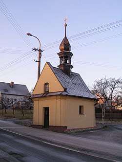 Old chapel | |||
| |||
 Location in the Czech Republic | |||
| Coordinates: 49°50′31″N 18°05′28″E / 49.84194°N 18.09111°ECoordinates: 49°50′31″N 18°05′28″E / 49.84194°N 18.09111°E | |||
| Country | Czech Republic | ||
| Region | Moravian-Silesian | ||
| District | Ostrava-City | ||
| Area | |||
| • Total | 5.36 km2 (2.07 sq mi) | ||
| Elevation | 292 m (958 ft) | ||
| Population (2014) | |||
| • Total | 1,435[1] | ||
| Postal code | 747 66 | ||
| Website |
www | ||


Dolní Lhota (German: Klein Ellgoth) is a village in Ostrava-City District, Moravian-Silesian Region, Czech Republic.
References
| Wikimedia Commons has media related to Dolní Lhota (Ostrava-City District). |
This article is issued from
Wikipedia.
The text is licensed under Creative Commons - Attribution - Sharealike.
Additional terms may apply for the media files.