Dolenje Otave
| Dolenje Otave | |
|---|---|
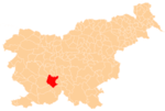
 Dolenje Otave Location in Slovenia | |
| Coordinates: 45°50′13.56″N 14°24′57.43″E / 45.8371000°N 14.4159528°ECoordinates: 45°50′13.56″N 14°24′57.43″E / 45.8371000°N 14.4159528°E | |
| Country |
|
| Traditional region | Inner Carniola |
| Statistical region | Littoral–Inner Carniola |
| Municipality | Cerknica |
| Area | |
| • Total | 2.04 km2 (0.79 sq mi) |
| Elevation | 793 m (2,602 ft) |
| Population (2002) | |
| • Total | 31 |
| [1] | |
Dolenje Otave (pronounced [dɔˈleːnjɛ ɔˈtaːʋɛ]; German: Unterotawe[2]) is a small village in the hills northeast of Begunje in the Municipality of Cerknica in the Inner Carniola region of Slovenia.[3]
References
- ↑ Statistical Office of the Republic of Slovenia
- ↑ Leksikon občin kraljestev in dežel zastopanih v državnem zboru, vol. 6: Kranjsko. 1906. Vienna: C. Kr. Dvorna in Državna Tiskarna, p. 122.
- ↑ Cerknica municipal site
External links
| Settlements | Administrative centre: Cerknica
|  |
|---|---|---|
| Landmarks | ||
This article is issued from
Wikipedia.
The text is licensed under Creative Commons - Attribution - Sharealike.
Additional terms may apply for the media files.