Dola, Ohio
| Dola, Ohio | |
|---|---|
| Census-designated place | |
 Aerial view of Dola | |
 Dola  Dola | |
| Coordinates: 40°47′1″N 83°41′34″W / 40.78361°N 83.69278°WCoordinates: 40°47′1″N 83°41′34″W / 40.78361°N 83.69278°W | |
| Country | United States |
| State | Ohio |
| County | Hardin |
| Township | Washington |
| Area | |
| • Total | 0.83 sq mi (2.15 km2) |
| • Land | 0.83 sq mi (2.15 km2) |
| • Water | 0.0 sq mi (0.0 km2) |
| Elevation[1] | 948 ft (289 m) |
| Population (2010) | |
| • Total | 140 |
| • Density | 168/sq mi (65.0/km2) |
| Time zone | UTC-5 (Eastern (EST)) |
| • Summer (DST) | UTC-4 (EDT) |
| ZIP Code | 45835 |
| Area code(s) | 419 |
| FIPS code | 39-22260[2] |
| GNIS feature ID | 1064545[1] |
Dola is a census-designated place in central Washington Township, Hardin County, Ohio, United States.[3] As of the 2010 United States Census it had a population of 140.[2] Although it is unincorporated, it has a post office, with the ZIP code of 45835.[4]
Geography
Dola is located along State Route 81 between Ada and Dunkirk, 12 miles (19 km) by road north-northwest of the city of Kenton, the county seat of Hardin County. Dola lies at the headwaters of the Eagle Creek, which flows north to meet the Blanchard River in Findlay.[5]
According to the U.S. Census Bureau, the Dola CDP has an area of 0.83 square miles (2.15 km2), all of it land.[2]
History
Dola was originally called "North Washington", and under the latter name was platted in 1852.[6] A post office was established as "North Washington" in 1854, and the name was changed to "Dola" in 1906.[7]
Education
Hardin Northern High School is 2 miles (3 km) east of the center of Dola, which is frequently named as the location of this high school, and sports media such as JJ Huddle often refer to the school as "Dola Hardin Northern".[8]
References
- 1 2 U.S. Geological Survey Geographic Names Information System: Dola, Ohio
- 1 2 3 "Geographic Identifiers: 2010 Census Summary File 1 (G001): Dola CDP, Ohio". American Factfinder. U.S. Census Bureau. Retrieved December 28, 2017.
- ↑ U.S. Geological Survey Geographic Names Information System: Dola, Ohio
- ↑ Zip Code Lookup Archived October 8, 2007, at the Wayback Machine.
- ↑ DeLorme. Ohio Atlas & Gazetteer. 7th ed. Yarmouth: DeLorme, 2004, pp. 36, 46. ISBN 0-89933-281-1.
- ↑ Kohler, Minnie Ichler (1910). A Twentieth Century History of Hardin County, Ohio: A Narrative Account of Its Historical Progress, Its People and Principal Interests. Lewis Publishing Company. p. 187.
- ↑ "Hardin County". Jim Forte Postal History. Archived from the original on 22 December 2015. Retrieved 14 December 2015.
- ↑ Frantz, Eric (2007-07-10). "Dola Hardin Northern 2007 Season Preview". JJ Huddle. Retrieved 2008-08-12.
Municipalities and communities of Hardin County, Ohio, United States | ||
|---|---|---|
| City | 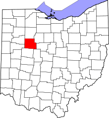 | |
| Villages | ||
| Townships | ||
| CDP | ||
| Unincorporated communities | ||
| Footnotes | ‡This populated place also has portions in an adjacent county or counties | |