Cessna Township, Hardin County, Ohio
| Cessna Township, Hardin County, Ohio | |
|---|---|
| Township | |
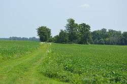 War of 1812 cemetery on Township Road 115 | |
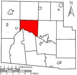 Location of Cessna Township, Hardin County, Ohio | |
| Coordinates: 40°42′3″N 83°42′6″W / 40.70083°N 83.70167°WCoordinates: 40°42′3″N 83°42′6″W / 40.70083°N 83.70167°W | |
| Country | United States |
| State | Ohio |
| County | Hardin |
| Area | |
| • Total | 22.9 sq mi (59.2 km2) |
| • Land | 22.9 sq mi (59.2 km2) |
| • Water | 0.0 sq mi (0.0 km2) |
| Elevation[1] | 1,007 ft (307 m) |
| Population (2010) | |
| • Total | 494 |
| • Density | 21/sq mi (8.3/km2) |
| Time zone | UTC-5 (Eastern (EST)) |
| • Summer (DST) | UTC-4 (EDT) |
| FIPS code | 39-13316[2] |
| GNIS feature ID | 1086258[1] |
Cessna Township is one of the fifteen townships of Hardin County, Ohio, United States. As of the 2010 census the population was 494.[3]
Geography
Located in the western center of the county, it borders the following townships:
- Washington Township - north
- Blanchard Township - northeast corner
- Pleasant Township - east
- Buck Township - southeast
- Lynn Township - south
- McDonald Township - southwest
- Marion Township - west
- Liberty Township - northwest corner
No municipalities are located in Cessna Township.
Name and history
Cessna Township was established in 1834, and named in honor of Charles Cessna, a pioneer settler.[4] It is the only Cessna Township statewide.[5]
Government
The township is governed by a three-member board of trustees, who are elected in November of odd-numbered years to a four-year term beginning on the following January 1. Two are elected in the year after the presidential election and one is elected in the year before it. There is also an elected township fiscal officer,[6] who serves a four-year term beginning on April 1 of the year after the election, which is held in November of the year before the presidential election. Vacancies in the fiscal officership or on the board of trustees are filled by the remaining trustees.
References
- 1 2 "US Board on Geographic Names". United States Geological Survey. 2007-10-25. Retrieved 2008-01-31.
- ↑ "American FactFinder". United States Census Bureau. Archived from the original on 2013-09-11. Retrieved 2008-01-31.
- ↑ "Geographic Identifiers: 2010 Census Summary File 1 (G001): Cessna township, Hardin County, Ohio". American Factfinder. U.S. Census Bureau. Retrieved December 28, 2017.
- ↑ Kohler, Minnie Ichler (1910). A Twentieth Century History of Hardin County, Ohio: A Narrative Account of Its Historical Progress, Its People and Principal Interests,. Lewis Publishing Company. p. 21.
- ↑ "Detailed map of Ohio" (PDF). United States Census Bureau. 2000. Retrieved 2007-02-16.
- ↑ §503.24, §505.01, and §507.01 of the Ohio Revised Code. Accessed 4/30/2009.
External links
Municipalities and communities of Hardin County, Ohio, United States | ||
|---|---|---|
| City | 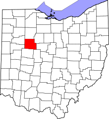 | |
| Villages | ||
| Townships | ||
| CDP | ||
| Unincorporated communities | ||
| Footnotes | ‡This populated place also has portions in an adjacent county or counties | |