Dobongsan station
Dobongsan Station | ||||||||||||||||
|---|---|---|---|---|---|---|---|---|---|---|---|---|---|---|---|---|
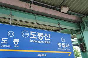 Station Nameplate (Line 1) | ||||||||||||||||
| Korean name | ||||||||||||||||
| Hangul | 도봉산역 | |||||||||||||||
| Hanja | 道峰山驛 | |||||||||||||||
| Revised Romanization | Dobongsannyeok | |||||||||||||||
| McCune–Reischauer | Tobongsannyŏk | |||||||||||||||
| General information | ||||||||||||||||
| Location |
363 Dobong 2-dong ( 964-33 Dobong-no ( Dobong-gu, Seoul[1][2] | |||||||||||||||
| Coordinates | 37°41′22″N 127°02′45″E / 37.68944°N 127.04583°ECoordinates: 37°41′22″N 127°02′45″E / 37.68944°N 127.04583°E | |||||||||||||||
| Operated by |
SMRT | |||||||||||||||
| Platforms |
2 ( | |||||||||||||||
| Tracks |
4 ( 2 ( | |||||||||||||||
| Construction | ||||||||||||||||
| Structure type | Aboveground | |||||||||||||||
| History | ||||||||||||||||
| Opened |
September 2, 1986 ( October 11, 1996 ( | |||||||||||||||
| Traffic | ||||||||||||||||
| Passengers |
Based on Jan–Dec of 2012. Line 1: 11,897[3] Line 7: 20,537[3] | |||||||||||||||
| Services | ||||||||||||||||
| ||||||||||||||||
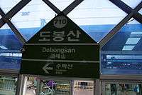
Station Nameplate (Line 7)
Dobongsan Station is a subway station on the Seoul Subway Line 1 and Line 7.[1][2] It is the closest station to Mt. Dobong, where its name also comes from.[2]
This station is geographically the northernmost station in Seoul. In addition, The Line 7 station is the only transfer station operated by SMRT that is not underground.
Station layout
Line 1
| ↑ Mangwolsa |
| | 1 2 | | 3 4 | |
| Dobong ↓ |
| 1 | ●Line 1 toward Soyosan → |
|---|---|
| 2 | ●Line 1 (Rapid) toward Dongducheon → |
| 3 | ← ●Line 1 (Rapid) toward Incheon |
| 4 | ← ●Line 1 toward Incheon |
Line 7
| Jangam ↑ |
| S/B | | N/B |
| ↓ Suraksan |
| Southbound | ← ●Line 7 toward Bupyeong-gu Office |
|---|---|
| Northbound | ●Line 7 toward Jangam → |
Exits
- Exit 1: Dobongsan, Dobong 1-dong Post Office, Dobongsan Parking lot, Seoul Garden Apartment House, Seoul Ingang School, Camp Jackson
- Exit 2: Nowon Elementary School, Dobongsimin Apartment House, Hansin Apartment House
References
- 1 2 3 4 "도봉산역" (in Korean). KRIC. Retrieved 2015-09-16.
- 1 2 Monthly Number of Passengers between Subway Stations Archived October 6, 2014, at the Wayback Machine.. Korea Transportation Database, 2013. Retrieved 2013-10-15.
External links
- (in Korean) Station information from Korail
| Wikimedia Commons has media related to Dobongsan station. |
This article is issued from
Wikipedia.
The text is licensed under Creative Commons - Attribution - Sharealike.
Additional terms may apply for the media files.