Dobšiná
| Dobšiná | ||
| Town | ||
 Town hall in Dobšiná | ||
|
||
| Country | Slovakia | |
|---|---|---|
| Region | Košice | |
| District | Rožňava | |
| Tourism region | Gemer | |
| Elevation | 468 m (1,535 ft) | |
| Coordinates | 48°49′14″N 20°21′57″E / 48.82056°N 20.36583°ECoordinates: 48°49′14″N 20°21′57″E / 48.82056°N 20.36583°E | |
| Area | 82.727 km2 (32 sq mi) | |
| Population | 5,125 (31 December 2005) | |
| Density | 62/km2 (161/sq mi) | |
| First mentioned | 1326 | |
| Mayor | Ján Slovák | |
| Timezone | CET (UTC+1) | |
| - summer (DST) | CEST (UTC+2) | |
| Postal code | 04925 | |
| Phone prefix | 421-58 | |
| Car plate | RV | |
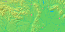
  Location of Dobšiná in Slovakia | ||
 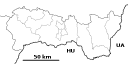 Location of Dobšiná in the Košice Region | ||
| Wikimedia Commons: Dobšiná | ||
| Statistics: MOŠ/MIS | ||
| Website: http://www.dobsina.sk | ||

Dobšiná (German: Dobschau; Hungarian: Dobsina; Latin: Dobsinium) is a town in the Slovenské rudohorie mountains (Slovak Ore Mountains) in Slovakia, on the Slaná River, north-west of Košice.
Geography
It is situated between Revúcka vrchovina and Volovské vrchy in the Carpathians, and lies to the south of the beautiful Stratená valley, watered by the river Hnilec, and enclosed on all sides by mountains. The well-known Dobšinská Ice Cave (discovered in 1870) in the valley and belongs to the territory of the village.[1]
History
The earliest surviving written reference to the place dates from 1326; it mentions that ethnic German mining experts had settled here.[1] It received a town charter in 1417, becoming a major town for the minority of Carpathian Germans and a center of mining (gold, silver, nickel, later iron, cobalt, copper, mercury etc.) and iron processing in the past. In the vicinity are mines of various materials, some of them very ancient.
Until the 18th century, Dobšiná was more or less a German enclave, but after strict Magyarization, the German community lost some of its strength, although it was still the dominant ethnic group in the town. Oddly enough, in 1927 there was a German (Buliner) Festival to celebrate the 600th anniversary, much of which was conducted in German, as the majority of the town still spoke it, as well as Hungarian. The church records from as early as the 1600s show that the town was still overwhelmingly German. The residents referred to themselves as Dobschauer or Topschauer and spoke a dialect of German called Buliner. During World War II, Slovak forces forced the ethnic Germans to leave, and at the war's end, when they were returning to their home, Slovak soldiers massacred most of them, thereby effectively destroying the German presence in the town. After the war, Slovaks from other parts of Czechoslovakia were resettled in the vacant homes.[2]
Demographics
According to the 2001 census, the town had 4,896 inhabitants, of whom 88.58 percent were Slovaks, 9.01 percent Roma, 0.63 percent Hungarians and 0.27 percent Czechs. German family names can still be found in the local telephone directory, but the holders of them have been assimilated as Slovaks.[3] The religious structure was 35.23 percent Roman Catholics, 33.58 percent people without religious affiliation, 25.25 percent Lutherans and 0.47 percent Greek Catholics.[3]
Twin towns — sister cities
Dobšiná is twinned with:


See also
References
- 1 2

- ↑ Chovan, Branislav (April 23, 2007) "Dobšiná: History Talks." The Slovak Spectator. (Retrieved 7-7-13.)
- 1 2 "Municipal Statistics". Statistical Office of the Slovak republic. Archived from the original on 2008-01-11. Retrieved 2008-01-31.
Genealogical resources
The records for genealogical research are available at the state archive "Statny Archiv in Banska Bystrica, Kosice, Slovakia"
- Roman Catholic church records (births/marriages/deaths): 1746–1923 (parish A)
- Greek Catholic church records (births/marriages/deaths): 1818–1895 (parish B)
- Lutheran church records (births/marriages/deaths): 1626–1944 (parish A)
External links
- Official website (in Slovak)
- Surnames of living people in Dobsina