Dielsdorf District
| Dielsdorf District Bezirk Dielsdorf | |
|---|---|
| District | |
 | |
| Country |
|
| Canton |
|
| Capital | Dielsdorf |
| Area | |
| • Total | 152.73 km2 (58.97 sq mi) |
| Population (31 December 2017) | |
| • Total | 89,561 |
| • Density | 590/km2 (1,500/sq mi) |
| Time zone | UTC+1 (CET) |
| • Summer (DST) | UTC+2 (CEST) |
| Municipalities | 22 |
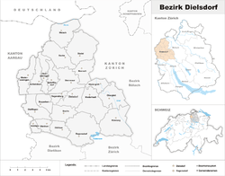
Coordinates: 47°29′N 8°27′E / 47.483°N 8.450°E Dielsdorf District is a district in the northwestern part of the Swiss canton of Zürich.
Since 1871 the administrative center of the district is located in Dielsdorf. Previously the district was named Bezirk Regensberg, and its capital was Regensdorf, the only city in the district.
Municipalities
| Name | Population (31 December 2017)[1] |
Area in km² |
SFSO number | |
|---|---|---|---|---|
| 8164 | Bachs | 593 | 9.12 | 0081 |
| 8113 | Boppelsen | 1,373 | 3.94 | 0082 |
| 8107 | Buchs | 6,315 | 5.87 | 0083 |
| 8108 | Dällikon | 4,118 | 4.50 | 0084 |
| 8114 | Dänikon | 1,879 | 2.80 | 0085 |
| 8157 | Dielsdorf | 5,966 | 5.86 | 0086 |
| 8115 | Hüttikon | 930 | 1.60 | 0087 |
| 8173 | Neerach | 3,151 | 6.01 | 0088 |
| 8172 | Niederglatt | 4,949 | 3.62 | 0089 |
| 8155 | Niederhasli | 9,202 | 11.24 | 0090 |
| 8166 | Niederweningen | 3,035 | 6.88 | 0091 |
| 8154 | Oberglatt | 6,988 | 8.29 | 0092 |
| 8165 | Oberweningen | 1,802 | 4.86 | 0093 |
| 8112 | Otelfingen | 2,842 | 7.23 | 0094 |
| 8158 | Regensberg | 474 | 2.39 | 0095 |
| 8105 | Regensdorf | 18,317 | 14.62 | 0096 |
| 8153 | Rümlang | 7,968 | 12.39 | 0097 |
| 8165 | Schleinikon | 736 | 5.65 | 0098 |
| 8165 | Schöfflisdorf | 1,405 | 4.05 | 0099 |
| 8174 | Stadel | 2,280 | 12.85 | 0100 |
| 8162 | Steinmaur | 3,482 | 9.39 | 0101 |
| 8187 | Weiach | 1,756 | 9.57 | 0102 |
| Total | 89,561 | 152.73 | 0104 |
See also
References
- ↑ Swiss Federal Statistical Office - STAT-TAB, online database – Ständige und nichtständige Wohnbevölkerung nach institutionellen Gliederungen, Geburtsort und Staatsangehörigkeit (in German) accessed 17 September 2018
This article is issued from
Wikipedia.
The text is licensed under Creative Commons - Attribution - Sharealike.
Additional terms may apply for the media files.