Desivojca
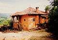
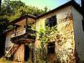
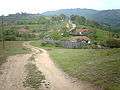
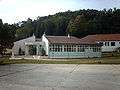
Desivojca is a village in the municipality of Kamenica, in the east of Kosovo.[lower-alpha 1] It has 16.41 km2 (6.34 sq mi) of land, 89 houses with 755 inhabitants (sources from 1995). It is about 50 km (31 mi) from Gjilan. The village has a primary school called "Kadri Zeka" and a mosque built in 1816. It is a center for surrounding villages.

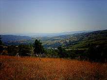
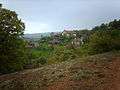
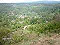
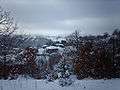
In the north it borders with the village of Huruglica (in Serbia), in north-east it borders with the village of Terstena, in the east is situated the village of Zarbinca and Pribovc, from south-east, south and west it is enclosed with the Laqiq village and in north-west is situated the village of Veleglava. Desivojca is a hilly mountainous area, with beautiful landscapes and developed vegetation. A river called Desivojca flows amidst dividing the village in two parts.
The highest peaks in this village are:
- Drumi i Xheles (1,228 m or 4,029 ft),
- Rrafshi (1,157 m or 3,796 ft),
- Strajdeja (1,138 m or 3,734 ft),
- Maja e Zezë (1,094 m or 3,589 ft),
- Maja e Sreshnjes 1070m,
- Cipeli 1037m,
- and the lowest attitude in Desivojca is Mulliri i Robajve 660m.

Desivojca has four main neighborhoods: Komani, Bunjaku, Padina and Zhigolli.
There are 12 main groups of families that live in Desivojca:
- Shkodra family,
- Bunjaku,
- Dragobuzhda,
- Mellova,
- Beshtica,
- Gurguroci,
- Gagica,
- Surdulli,
- Klaiqi
- Rukoci
- Bajraliu
- Robelli
Many inhabitants from this village now live in urban centers like Gnjilane, Kosovska Kamenica, Pristina, Uroševac, etc.
Gallery


Notes and references
Notes:
- ↑ Kosovo is the subject of a territorial dispute between the Republic of Kosovo and the Republic of Serbia. The Republic of Kosovo unilaterally declared independence on 17 February 2008, but Serbia continues to claim it as part of its own sovereign territory. The two governments began to normalise relations in 2013, as part of the Brussels Agreement. Kosovo has received formal recognition as an independent state from 113 out of 193 United Nations member states.
References:
Coordinates: 42°39′32″N 21°44′21″E / 42.65889°N 21.73917°E