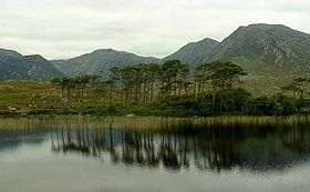
Derryclare Lough
| Derryclare Lough Loch Dhoire an Chláir | |
|---|---|
 | |
 Location in Ireland | |
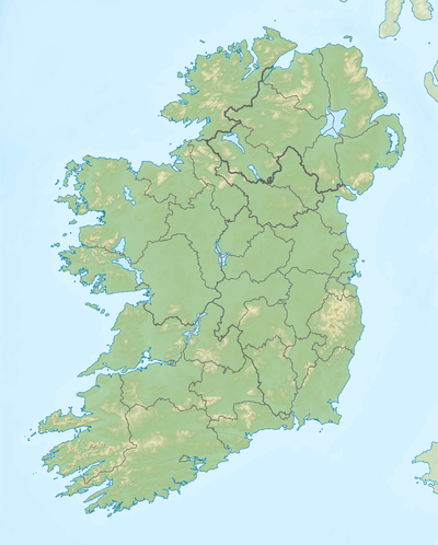
| Location | County Galway |
| Coordinates | 53°28′17″N 9°46′38″W / 53.47139°N 9.77722°WCoordinates: 53°28′17″N 9°46′38″W / 53.47139°N 9.77722°W |
| Catchment area | 111.73 km2 (43.1 sq mi) |
| Basin countries | Ireland |
| Max. length | 4 km (2.5 mi) |
| Max. width | 1 km (0.6 mi) |
| Surface area | 2.24 km2 (0.86 sq mi) |
| Surface elevation | 10 m (33 ft) |
| References | [1][2][3] |
Derryclare Lough (Irish: Loch Dhoire an Chláir)[1] is a freshwater lake in the west of Ireland. It is located in the Connemara area of County Galway.
Geography
Derryclare Lough is located about 20 km (12 mi) east of Clifden and about 60 km (37 mi) northwest of Galway city. The Twelve Bens mountain range lies to the north of the lake.[2]
See also
References
- 1 2 "Loch Dhoire an Chláir/Derryclare Lough". Placenames Database of Ireland. Government of Ireland - Department of Arts, Heritage and the Gaeltacht and Dublin City University. Retrieved 27 Dec 2015.
- 1 2 Google (27 Dec 2015). "Derryclare Lough" (Map). Google Maps. Google. Retrieved 27 Dec 2015.
- ↑ "A Reference Based Typology and Ecological Assessment System for Irish Lakes" (PDF). Environmental Protection Agency (Ireland). 2006. p. 17. Retrieved 27 Dec 2015.
This article is issued from
Wikipedia.
The text is licensed under Creative Commons - Attribution - Sharealike.
Additional terms may apply for the media files.