Delta, Mississippi
| Delta, Mississippi | |
|---|---|
| Ghost town | |
 Delta | |
| Coordinates: 34°24′16″N 90°34′20″W / 34.40444°N 90.57222°WCoordinates: 34°24′16″N 90°34′20″W / 34.40444°N 90.57222°W | |
| Country | United States |
| State | Mississippi |
| County | Coahoma |
| Elevation | 174 ft (53 m) |
| Time zone | UTC-6 (Central (CST)) |
| • Summer (DST) | UTC-5 (CDT) |
| GNIS feature ID | 691807[1] |
Delta is a ghost town in Coahoma County, Mississippi, United States.
Once a thriving port on the Mississippi River, Delta today is covered by farmland and a portion of the Mississippi Levee. Nothing remains of the original settlement.
History
The county seat was moved from Port Royal to Delta in 1842.
In 1844, Delta was surveyed and laid off into lots. The town had a population of about 700, and was a busy steamboat port.
Delta incorporated in 1848. That same year, the river flooded the town, forcing many residents to relocate to nearby Friars Point.
The county seat was moved to Friars Point in 1850.[2]
By 1890, nothing remained of Delta.[3]
References
- ↑ U.S. Geological Survey Geographic Names Information System: Delta, Mississippi
- ↑ Kerstine, Margery (January 7, 2011). "Cotton-Family-Religion: Jewish Life in Coahoma County Mississippi, Delta History from 1836 to 1941, Prologue: 1721 to 1867". Margery Kerstine.
- ↑ Bragg, Marion (1977). Historic Names and Places on the Lower Mississippi River (PDF). Mississippi River Commission. p. 100.
Municipalities and communities of Coahoma County, Mississippi, United States | ||
|---|---|---|
| City | 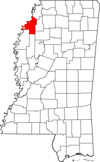 | |
| Towns | ||
| CDP | ||
| Other unincorporated communities | ||
| Ghost towns | ||
| Footnotes | ‡This populated place also has portions in an adjacent county or counties | |
This article is issued from
Wikipedia.
The text is licensed under Creative Commons - Attribution - Sharealike.
Additional terms may apply for the media files.