Delhi Charter Township, Michigan
| Charter Township of Delhi | |
|---|---|
| Charter township | |
 Delhi Charter Township sign along Cedar Street | |
 Charter Township of Delhi Location within the state of Michigan | |
| Coordinates: 42°37′58.8″N 84°32′16.7″W / 42.633000°N 84.537972°WCoordinates: 42°37′58.8″N 84°32′16.7″W / 42.633000°N 84.537972°W | |
| Country | United States |
| State | Michigan |
| County | Ingham |
| Settled | 1837 |
| Organization | 1842 |
| Government | |
| • Type | Charter township |
| • Supervisor | John Hayhoe (R) |
| Area | |
| • Total | 29.0 sq mi (75 km2) |
| • Land | 28.6 sq mi (74 km2) |
| • Water | 0.4 sq mi (1 km2) |
| Elevation | 892 ft (277.8 m) |
| Population (2010) | |
| • Total | 25,877 |
| • Estimate (2017[1]) | 27,495 |
| • Density | 904.4/sq mi (349.2/km2) |
| Time zone | UTC-5 (EST) |
| • Summer (DST) | UTC-4 (EDT) |
| ZIP code | 48842 |
| Area code(s) | 517 |
| FIPS code | 26-21420[2] |
| GNIS feature ID | 1626174[3] |
| Website | http://www.delhitownship.com/ |
Delhi Charter Township (/ˈdɛlhaɪ/ DEL-hy) is a charter township of Ingham County in the U.S. state of Michigan, located directly south of the state's capital city, Lansing. The population was 25,877 at the 2010 census, an increase from 22,569 in 2000.[4] Delhi Township is the fifth-largest municipality in Metro Lansing, and part of the Lansing Urban Area.
Communities
- Holt is an unincorporated community in the township that is also a census-designated place for statistical purposes. Holt is just south of Interstate 96 and is about 6 miles northwest of Mason. About half the population of Delhi live in Holt, but many others (even outside the township) identify themselves as living in Holt, because they attend Holt Public Schools.
- The city of Lansing is adjacent to the north and has incorporated land that was formerly within the township. Much of the township is considered to be part of the Greater Lansing urban area.
- The city of Mason is nearby to the southeast and the village of Dimondale is to the west.
Geography
According to the United States Census Bureau, the township has a total area of 29.0 square miles (75 km2), of which 28.6 square miles (74 km2) is land and 0.4 square miles (1.0 km2) (1.45%) is water. The Grand River flows through the southwestern part of the township, and Sycamore Creek flows through its northeastern part.[5]
History
The first permanent settlers in Delhi Township, John Norris and Fred Luther, arrived in 1837. In 1850, 402 settlers resided in the township.[6] By 1857 Delhi Center (now Holt) had a post office, hotel, tavern, and several other businesses.
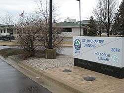
and Holt-Delhi Library
Demographics
| Historical population | |||
|---|---|---|---|
| Census | Pop. | %± | |
| 1960 | 16,590 | — | |
| 1970 | 13,795 | −16.8% | |
| 1980 | 17,144 | 24.3% | |
| 1990 | 19,190 | 11.9% | |
| 2000 | 22,569 | 17.6% | |
| 2010 | 25,877 | 14.7% | |
| Est. 2017 | 27,495 | 6.3% | |
| U.S. Decennial Census | |||
As of the census[2] of 2000, there were 22,569 people, 8,563 households, and 6,268 families residing in the township. The population density was 783.2 per square mile (302.5/km²). There were 8,988 housing units at an average density of 311.9 per square mile (120.5/km²). The racial makeup of the township was 92.95% White, 2.36% African American, 0.49% Native American, 1.15% Asian, 0.04% Pacific Islander, 0.94% from other races, and 2.06% from two or more races. Hispanic or Latino of any race were 3.56% of the population.
Households
There were 8,563 households out of which 40.0% had children under the age of 18 living with them, 57.4% were married couples living together, 11.9% had a female householder with no husband present, and 26.8% were non-families. 22.2% of all households were made up of individuals and 7.6% had someone living alone who was 65 years of age or older. The average household size was 2.61 and the average family size was 3.06.
Ages
In the township the population was spread out with 28.9% under the age of 18, 7.1% from 18 to 24, 30.7% from 25 to 44, 23.7% from 45 to 64, and 9.6% who were 65 years of age or older. The median age was 36 years. For every 100 females, there were 91.5 males. For every 100 females age 18 and over, there were 87.5 males.
Income
The median income for a household in the township was $50,922, and the median income for a family was $61,837. Males had a median income of $45,774 versus $31,192 for females. The per capita income for the township was $23,485. About 3.2% of families and 5.2% of the population were below the poverty line, including 5.8% of those under age 18 and 5.9% of those age 65 or over.
References
- Notes
- ↑ "Population Estimates". United States Census Bureau. Retrieved 2018-07-12.
- 1 2 "American FactFinder". United States Census Bureau. Archived from the original on 2013-09-11. Retrieved 2008-01-31.
- ↑ U.S. Geological Survey Geographic Names Information System: Delhi Charter Township, Michigan
- ↑ American Factfinder, U.S. Census Bureau. Population and Housing Occupancy Status: 2010 - State -- County Subdivision, census.gov, retrieved 2011-Apr-14
- ↑ The National Map Archived 2012-04-05 at WebCite, accessed 2015-09-23
- ↑ Felton 1987, pp. 3–5
- Bibliography
Felton, Jim; Inge Kyler; Russ Jessop; Nancy Meese; Leon North; Guy Sweet; Gregory N. Veltema; Harvey Wood (1987). A Michigan Sesquicentennial History of Delhi Township. Holt, Michigan: Michigan Sesquicentennial Agency for Delhi Township. pp. 3–23.
External links
- Official Website of the Charter Township of Delhi
- Holt–Delhi Branch of the Capital Area District Library
Municipalities and communities of Ingham County, Michigan, United States | ||
|---|---|---|
| Cities | 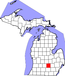 | |
| Villages | ||
| Charter townships | ||
| General law townships | ||
| CDPs | ||
| Other unincorporated communities | ||
| Footnotes | ‡This populated place also has portions in an adjacent county or counties | |