Delhi, Louisiana
| Town of Delhi | |
|---|---|
| City | |
 Delhi City Hall | |
 Location of Delhi in Richland Parish, Louisiana. | |
.svg.png) Location of Louisiana in the United States | |
| Coordinates: 32°27′21″N 91°29′36″W / 32.45583°N 91.49333°WCoordinates: 32°27′21″N 91°29′36″W / 32.45583°N 91.49333°W | |
| Country | United States |
| State | Louisiana |
| Parish | Richland |
| Government | |
| • Type | Mayor-council |
| Area[1] | |
| • Total | 2.94 sq mi (7.62 km2) |
| • Land | 2.94 sq mi (7.62 km2) |
| • Water | 0.00 sq mi (0.00 km2) |
| Elevation | 89 ft (27 m) |
| Population (2010) | |
| • Total | 3,248 |
| • Estimate (2016)[2] | 3,189 |
| • Density | 978.25/sq mi (377.65/km2) |
| Time zone | UTC-6 (CST) |
| • Summer (DST) | UTC-5 (CDT) |
| Area code(s) | 318 |
| FIPS code | 22-20190 |


_IMG_7439.JPG)
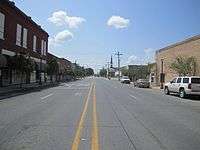
Delhi, originally called Deerfield, is a town in Richland Parish, Louisiana, United States. As of the 2010 census, the town population was 3,289.
History
During the American Civil War, Delhi and Monroe, the seat of Ouachita Parish, were overcrowded with unwelcome refugees from rural areas to the east when the forces of General U.S. Grant moved into northeastern Louisiana. Grant spent the winter of 1862-1863 at Winter Quarters south of Newellton in Tensas Parish in preparation for the siege of Vicksburg, Mississippi. He did not take the river port city until July 4, 1863. Historian John D. Winters reported "strong Union sympathy" in both Delhi and Monroe.[3]
In the 1940s, Delhi was the center of a large natural gas boom. Numerous workers came to work in the industry. Several functioning gas fields still surround the town.
From 1968-1969, Delhi Fire Department was home to the now defunct Louisiana State Police - Troop O. The site was abandoned in 1969 after thirteen months' operation, with state services reverting to be provided by Troop F in Monroe.[4]
On February 21, 1971, Louisiana's only recorded F5 tornado struck outside of Delhi. It resulted in forty-six deaths and was the deadliest F5 tornado to hit the United States since the Jackson, Mississippi, Candlestick Park Tornado in 1966. It was the earliest confirmed F5 tornado during a year.
Delhi has a drug store, the E.W. Thomsom Drug Company, which has operated continuously since 1873 in the same downtown location. The company has been owned for four generations by the McEacharn family, who purchased it from the Thomsons in the early 1920s. Pharmacist Wilfred Bruce McEacharn (born 1956) is the current owner. The lunch counter sells hand-crafted milk shakes and old-fashioned fountain Coca-Colas. Popular menu items include cheeseburgers and plates of tuna and chicken salad. Shari McEacharn, his wife, operates a gift shop within the drug store. The Thomson Company remains a mainstay of Delhi for all generations of patrons.[5]
Geography
Delhi is located at 32°27′21″N 91°29′36″W / 32.45583°N 91.49333°W (32.455948, -91.493345).[6] The town lies at the confluence of U.S. Route 80 and Louisiana Highway 17, and near to Interstate 20.
According to the United States Census Bureau, the town has a total area of 2.6 square miles (6.7 km2), of which 2.5 square miles (6.5 km2) is land and 0.1 square mile (2.33%) is water.
The elevation of 89 ft (27 m) spared Delhi from the brunt of the Great Mississippi Flood of 1927 that destroyed most of the surrounding Mississippi River Delta area.
The Poverty Point Reservoir, which hosts the acclaimed Black Bear Golf Club and the Poverty Point Reservoir State Park, is located just north of Delhi on Louisiana State Highway 17 near Warden. The reservoir project was pushed to fruition by State Senator Francis C. Thompson of Delhi.
Demographics
| Historical population | |||
|---|---|---|---|
| Census | Pop. | %± | |
| 1870 | 186 | — | |
| 1880 | 315 | 69.4% | |
| 1890 | 620 | 96.8% | |
| 1900 | 507 | −18.2% | |
| 1910 | 685 | 35.1% | |
| 1920 | 980 | 43.1% | |
| 1930 | 1,043 | 6.4% | |
| 1940 | 1,192 | 14.3% | |
| 1950 | 1,861 | 56.1% | |
| 1960 | 2,514 | 35.1% | |
| 1970 | 2,887 | 14.8% | |
| 1980 | 3,290 | 14.0% | |
| 1990 | 3,169 | −3.7% | |
| 2000 | 3,066 | −3.3% | |
| 2010 | 2,919 | −4.8% | |
| Est. 2016 | 2,879 | [2] | −1.4% |
| U.S. Decennial Census[7] | |||
As of the census[8] of 2000, there were 3,066 people, 1,129 households, and 788 families residing in the town. The population density was 1,215.2 people per square mile. There were 1,253 housing units at an average density of 496.6 per square mile. The racial makeup of the town was 42.24% White, 56.78% African American, 0.07% Native American, 0.10% Asian, 0.36% from other races, and 0.46% from two or more races. Hispanic or Latino of any race were 0.98% of the population.
There were 1,129 households out of which 32.4% had children under the age of 18 living with them, 41.5% were married couples living together, 24.5% had a female householder with no husband present, and 30.2% were non-families. 27.3% of all households were made up of individuals and 15.7% had someone living alone who was 65 years of age or older. The average household size was 2.54 and the average family size was 3.10.
In the town, the population was spread out with 26.7% under the age of 18, 10.2% from 18 to 24, 25.9% from 25 to 44, 18.4% from 45 to 64, and 18.9% who were 65 years of age or older. The median age was 36 years. For every 100 females, there were 80.8 males. For every 100 females age 18 and over, there were 76.0 males.
The median income for a household in the town was $21,763, and the median income for a family was $25,651. Males had a median income of $25,054 versus $12,837 for females. The per capita income for the town was $11,161. About 26.2% of families and 31.6% of the population were below the poverty line, including 45.7% of those under age 18 and 21.8% of those age 65 or over.
Education
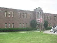
Public schools in Richland Parish are operated by the Richland Parish School Board. Three campuses serve the town of Delhi - Delhi Elementary School (Grades PK-4), Delhi Middle School (Grades 5-8), Delhi High School (Grades 9-12)..
Delhi Charter School (DCS) (K-12) is an area charter school.
Notable people
- John Henry Baker, farmer, landholder and Republican politician
- Lenny Fant, basketball coach at the University of Louisiana at Monroe from 1957–1979, coached at Delhi High School from 1950-1953
- Earl Holliman, Golden Globe award-winning film and television actor known for movies such as The Sons of Katie Elder, Gunfight at the O.K. Corral and Giant and TV series Police Woman
- Arlene Howell, Miss Louisiana USA 1958, Miss USA 1958 and television actress
- Bnois King, jazz and blues musician, was born in Delhi
- Charles A. Marvin, judge of the Louisiana Court of Appeal for the Second Circuit from 1975 to 1999; worked as news editor at Delhi Dispatch c. 1950[9]
- Tim McGraw, country singer originally from Start[10]
- Pat "Gravy" Patterson, longtime baseball coach at Louisiana Tech University
- Steve Pylant, former sheriff of Franklin Parish and Republican member of the Louisiana House of Representatives, resides in Franklin Parish near Delhi
- Charles and Sam Wyly, businessmen who endowed Wyly Tower of Learning at Louisiana Tech
References
- ↑ "2016 U.S. Gazetteer Files". United States Census Bureau. Retrieved Jul 2, 2017.
- 1 2 "Population and Housing Unit Estimates". Retrieved June 9, 2017.
- ↑ John D. Winters, The Civil War in Louisiana, Baton Rouge: Louisiana State University Press, 1963, ISBN 0-8071-0834-0, pp. 308-309
- ↑ "Troop History", Louisiana State Police
- ↑ "Greg Hilburn, Delhi drug store celebrates 140 years: E. W. Thomson Drug Co. remains touchstone for community". Monroe News-Star. October 7, 2013. Archived from the original on June 10, 2015. Retrieved October 8, 2013.
- ↑ "US Gazetteer files: 2010, 2000, and 1990". United States Census Bureau. 2011-02-12. Retrieved 2011-04-23.
- ↑ "Census of Population and Housing". Census.gov. Archived from the original on May 12, 2015. Retrieved June 4, 2015.
- ↑ "American FactFinder". United States Census Bureau. Archived from the original on 2013-09-11. Retrieved 2008-01-31.
- ↑ "LSU Law School recognizes Judge C.A. Marvin", Minden Press-Herald, June 5, 1990, p. 10
- ↑ Stambler, Irwin; Landon, Grelun (14 July 2000). Country Music: The Encyclopedia. St. Martin's Press. p. 307. ISBN 978-0-312-26487-1.
External links
- Delhi Progress, Community Progress Site for Delhi, LA
- Delhi Sweet Potato Plant, Sweet Potato Plant Greeniest Biggest In The World!!
Municipalities and communities of Richland Parish, Louisiana, United States | ||
|---|---|---|
| Towns |  | |
| Village | ||
| CDP | ||
| Other unincorporated communities | ||