Delaware Route 17
| ||||
|---|---|---|---|---|
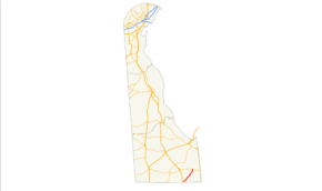 DE 17 marked in red | ||||
| Route information | ||||
| Maintained by DelDOT | ||||
| Length | 8.30 mi[1] (13.36 km) | |||
| Existed | 1938[2] – present | |||
| Major junctions | ||||
| South end |
| |||
|
| ||||
| North end |
| |||
| Location | ||||
| Counties | Sussex | |||
| Highway system | ||||
| ||||

Delaware Route 17 (DE 17) is a two-lane undivided state highway located in Sussex County, Delaware. The route runs in a northeast-southwest direction between DE 54 in Selbyville and DE 26 west of Millville, crossing DE 20 in Roxana. It is called Bethany Road within Selbyville and Roxana Road for the remainder of its length. The route passes through rural areas of southeastern Sussex County. DE 17 serves to connect Selbyville with the Bethany Beach area. The route was built as a state highway in the 1920s and received the DE 17 designation by 1938.
Route description

DE 17 begins at an intersection with DE 54 in the town of Selbyville, where it heads northeast on Bethany Road. The route is a two-lane, undivided, asphalt road that runs through flat areas of the Atlantic coastal plain its entire length. From the southern terminus, the road passes several homes before leaving Selbyville. At this point, DE 17 enters a mix of farmland and woodland with some homes. Here, the name of road becomes Roxana Road. Upon reaching the community of Roxana, the roadway crosses DE 20. After DE 20, the road continues through rural areas. Following a turn to the north, the route comes to its terminus at an intersection with DE 26 to the west of the town of Millville.[3][4]
In 2016, DE 17 had an annual average daily traffic count ranging from a high of 4,571 vehicles at the northern terminus at DE 26 to a low of 3,124 vehicles at the northern border of Selbyville.[1] None of DE 17 is part of the National Highway System.[5] The portion of DE 17 between Daisey Road and Peppers Corner Road serves as part of a hurricane evacuation route from the coastal community of South Bethany, providing an alternate to DE 26 to the north.[6][7]
History
By 1920, what is now DE 17 was under construction as an unnumbered paved state highway between Selbyville and Roxana, with a small section of paved state highway complete near Roxana. It was also designated as a state aid road, a road that was to receive funding from the state to be built as a state highway by the county, from Roxana north to Millville.[8] All of the route had been completed as an unnumbered paved state highway by 1924.[8][9] DE 17 was designated by 1938 to run from DE 54 in Selbyville to DE 26 near Millville.[10][2] The route has remained on the same alignment since.[3][2]
Major intersections
The entire route is in Sussex County.
| Location | mi[1] | km | Destinations[3] | Notes | |
|---|---|---|---|---|---|
| Selbyville | 0.00 | 0.00 | Southern terminus | ||
| Roxana | 3.84 | 6.18 | |||
| Millville | 8.30 | 13.36 | Northern terminus | ||
| 1.000 mi = 1.609 km; 1.000 km = 0.621 mi | |||||
See also


References
- 1 2 3 Staff (2016). "Traffic Count and Mileage Report: Interstate, Delaware, and US Routes" (PDF). Delaware Department of Transportation. Retrieved December 29, 2017.
- 1 2 3 Delaware State Highway Department; The National Survey Co. (1938). Official Road Map of the State of Delaware (PDF) (Map). Dover: Delaware State Highway Department. Retrieved November 24, 2015.
- 1 2 3 Delaware Department of Transportation (2017). Official Travel & Transportation Map (Map). Dover: Delaware Department of Transportation.
- ↑ Google (March 17, 2010). "overview of Delaware Route 17" (Map). Google Maps. Google. Retrieved March 17, 2010.
- ↑ National Highway System: Delaware (PDF) (Map). Federal Highway Administration. 2010. Retrieved February 10, 2012.
- ↑ Magill, Kerin (July 29, 2008). "Hurricane Isabel Wrapup". Sussex County Online. Retrieved August 6, 2012.
- ↑ Harvey, Sam. "South Bethany outlines evacuation route". Coastal Point. Retrieved August 6, 2012.
- 1 2 Delaware State Highway Department (1920). Official Road Map (PDF) (Map). Dover: Delaware State Highway Department. Retrieved November 24, 2015.
- ↑ Delaware State Highway Department (1924). Official Road Map (PDF) (Map). Dover: Delaware State Highway Department. Retrieved November 24, 2015.
- ↑ Delaware State Highway Department; The National Survey Co. (1936). Official Road Map of the State of Delaware (PDF) (Map) (1936–1937 ed.). Dover: Delaware State Highway Department. Retrieved November 24, 2015.
External links
Route map:
